Analysis of effective range of trackers: characteristics and selection of different types of trackers
In the modern world, trackers have become“Invisible assistants” that infiltrate every aspect of life and work, from helping users retrieve lost keys and wallets to monitoring the movements of logistics vehicles in real time. From keeping pets safe to providing location-based support for outdoor explorers… … to the need to confirm a location. However, when people choose a tracker, the most important question is often, “How far can it track?”
![]()
In fact, the tracker’s“Range” is not a fixed number, its core depends on the underlying technology. Different types of trackers have different scenarios and coverage. This article will analyze the mainstream tracking technologies such as Bluetooth, GPS, WI-FI, RFID and so on, and unveil the mystery of“Tracking range”.
Part 1: Bluetooth trackers-the Gatekeepers at your fingertips
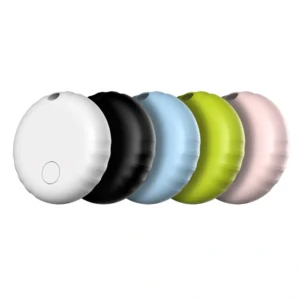
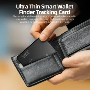
Bluetooth tracker is the most common type in daily life, with small portable, low power consumption characteristics, become the“Anti-lost” scene of choice. They can be further divided into two categories based on functionality:
1. Close proximity Bluetooth tracker: relies solely on its Bluetooth range
This kind of tracker is the basic application of Bluetooth technology. It does not have the function of cross-device network coordination, and the positioning range is strictly limited by the coverage distance of its Bluetooth signal.
Technical features: only through the establishment of a Bluetooth connection with the user’s personal mobile phone to achieve positioning, no“Social network” support. When the device is out of the range of Bluetooth, it can only record the location of the last connection, and can not obtain real-time updates.
![]()
Valid Range:
Theoretical Range: due to the limitation of Bluetooth version, the theoretical range of traditional Bluetooth (such as 4.2 and below) is mostly 10-30 meters, while Bluetooth 5.0 can reach 100 meters, but both sides of the device need to support this version.
Actual range: by the wall, metal, electromagnetic interference, the actual effective distance is usually reduced to 5-20 meters, old equipment even less than 5 meters.
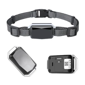
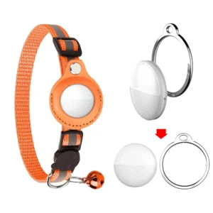
Representative products: early Bluetooth anti-lost device (such as some domestic brand key chain tracker) , basic pet collar tracker (no networking function) .
Scenarios: for short range, fixed scenarios only, e.g:
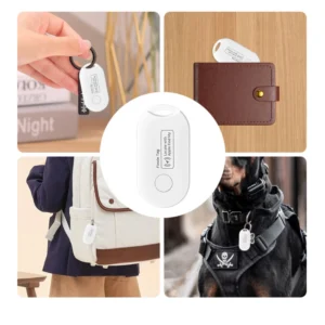
Look for small items such as remote controls and glasses at home
Keep backpacks at the gym
Follow a pet up close, eg in a yard.
2. Globally available Smart tags: extending reach with a network of devices
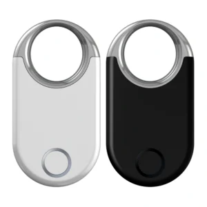
Smart tags, represented by Apple AirTag and Samsung Smarttag, are the advanced form of Bluetooth trackers. Their core advantage is to break through the physical distance limit with the help of a“Crowdsourcing network” of user devices around the world.
![]()
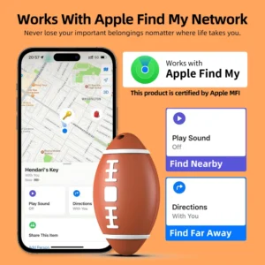
Technical features: in addition to the basic Bluetooth connection, you can connect to the brand’s eco-friendly global network of devices (e.g. AirTag to Apple Find My network, Samsung Smarttag to SmartThings network) . When the tag is out of the range of the user’s phone and enters the Bluetooth coverage area of other brand devices, it will be automatically uploaded to the cloud anonymously through the device, and the user can view it in real time.
Valid Range:
Own Bluetooth coverage: consistent with the close-range model, a single device connection range of 10-30 meters;
Network expansion: In theory, in the brand device coverage dense area (such as the world’s major cities) can achieve“Borderless” positioning. For example, an AirTag in an area with high apple device penetration, even if lost in another city, could be picked up by a nearby iPhone user’s device.
Technical limitations:
Rely on brand user base: in remote areas or brand equipment scarce areas, positioning efficiency dropped significantly;
Privacy Protection Mechanism: location information is transmitted anonymously through encryption, which can only be viewed by users to avoid data leakage.
Products represented: Apple AirTag, Samsung Galaxy Smarttag + , Tile Pro (Tile Network support) .
Scenario: valuables or high-frequency items that need to be looked for across the region, e.g:
Prevent luggage loss when traveling (even if it is lost in a foreign airport, it may also be located by other user equipment) ;
Keep track of backpacks and laptops
Expand your search for lost pets (especially in urban settings) .
Part 2: GPS trackers-clairvoyant vision across geographies
Unlike Bluetooth trackers, GPS trackers use satellite positioning technology to track people across cities and even around the world, it’s a key tool in logistics, transportation, and the outdoors.
Introduction to technology
The GPS tracker calculates its latitude, longitude and altitude by receiving signals from at least four global positioning system (GPS-RRB- satellites. To transmit location data to the user, it usually requires an additional network: either a cellular mobile network (2G/3G/4G/5G) to the server, or satellite communications to transmit the signal directly.
![]()
Categories and ranges
The range of a GPS tracker varies dramatically, depending on how the data is transmitted:
GPS tracker based on cellular network
How it works: After positioning, the location data is sent to the user terminal through the ground mobile base station (such as mobile phone APP, computer platform) .
Effective Range: in theory, as long as there are cellular network coverage area (such as cities, towns) , can be achieved without distance limit tracking. In China, for example, the tracker updates its location in real time wherever the phone can pick up a signal.
Limitations: you can’t transmit data in remote mountain areas, deserts, oceans, and other areas without cell phone coverage. You can only record your location (some devices can store data offline and sync it when you get back to the area) .
GPS tracker based on satellite communication
How it works: it doesn’t rely on terrestrial networks, but sends location information directly through satellite phone networks (such as iridium satellites and beidou short messages) .
Effective range: to achieve true“Global coverage”, whether in the ocean, polar, no man’s land, can be stable transmission of location data, ocean-going ships, expeditions, mountaineering explorers necessary equipment.
Cost considerations: the equipment is expensive (often in the thousands) and requires a satellite service fee (based on data or time spent) , much higher than a cellular network tracker.
Scenarios
GPS tracker for cellular network: apply to vehicle anti-theft (such as private cars, trucks) , logistics and transportation monitoring (real-time view of truck location) , Take-away/express rider trajectory management, etc. .
Satellite GPS Tracker: suitable for ocean freight, polar expeditions, jungle exploration, wildlife migration research and other extreme environments.
Part 3: other tracking technologies and their scope
In addition to Bluetooth and GPS, WI-FI and RFID technologies also play a role in tracking in certain scenarios. Although their scope is limited, they can not be replaced in the field of segmentation.
WI-FI tracking
How it works: by scanning nearby WI-FI hotspots, such as routers, to get the MAC address of the hotspot and matching it with the registration location in a cloud database, you can determine your location.
Effective range: limited to areas with WI-FI hotspot coverage (e. g. City buildings, shopping malls, homes) . The coverage radius of a single hotspot is usually 10-50 meters. Accuracy is superior to GPS in indoor environments (GPS signals are easily blocked by walls) and is often used as a GPS-assisted positioning method (such as mobile phone navigation switching to WI-FI positioning indoors) .
Applicable scenarios: goods tracking in shopping malls, indoor robot navigation, home security equipment positioning, etc. .
RFID (radio frequency identification) tracking
How it works: RFID signals are used to identify objects. There are two types of RFID: Passive and active:
![]()
Passive RFID: No built-in Battery, rely on radio frequency signal emitted by the reader power supply, the signal range is very short (usually 0.1-10 meters, depending on the frequency) .
Active RFID: with battery, can actively transmit signal, the range can reach 50-300 meters, some industrial equipment and even farther.
Applicable scenarios: passive RFID is widely used in warehouse inventory management (such as supermarket commodity labels) , access cards, ETC charges; Active RFID is suitable for large warehouse cargo tracking, factory equipment location, livestock breeding (long-distance identification of livestock) , etc. .
Part 4: the key factors that affect the range of a tracker

Regardless of the technology, the effective range of a tracker is limited by a number of factors that must be considered when choosing and using a tracker:
Technology type: this is the most fundamental determinant (e. g. Bluetooth 10-30 meters vs. satellite GPS global coverage) .
Environmental factors: physical obstacles (walls, metal, mountains) can weaken the signal; heavy rain, fog and other weather can interfere with GPS or satellite signals.
Network coverage: devices that rely on cellular or WI-FI networks will fail in signal dead zones; satellite networks have wide coverage, but may suffer from“Multipath effects” in high-rise areas.
Battery life: when the device is low on battery life, it may shorten the frequency of signal transmission (e.g. from real-time updates to updates every 10 minutes) , indirectly affecting the perception of“Range”.
Equipment quality: inferior antennas or chips can cause signal attenuation, while better equipment has a more stable range with the same technology.
Conclusion
From the proximity of Bluetooth trackers to the global reach of satellite GPS, the range of trackers has always been deeply tied to the mechanics of the technology:
In the Bluetooth tracker, the close-range model is suitable for short-range anti-lost in fixed scenes, and the Smart Tag relies on the device network to achieve cross-regional positioning;
GPS trackers rely on satellite positioning to achieve long-range tracking, cellular networks balance cost and range, and satellites conquer extreme environments;
Wi-Fi and RFID technologies offer the advantage of precise location indoors or in specific scenarios.
When choosing a tracker, make sure you know what you’re looking for: Bluetooth for the tracking key, cellular GPS for monitoring trucks, and satellite technology for ocean voyages. In the future, with the development of Internet of things (IoT) and low power wide area network (Lpwan) technologies, trackers will evolve to“Longer distance, lower power, and higher accuracy”, unlock greater potential in areas such as smart cities and Smart Logistics.

