Introduction
In modern America, location technology has infiltrated every aspect of daily life: Apps Show Drivers’ locations in real time while commuting with Uber in the morning; Amazon couriers rely on location to get packages to their doorsteps in 30 minutes; Disneyland visitors use indoor location in mobile apps to find the shortest lines for popular rides Even when someone calls 911 in a remote mountain area, emergency services can locate the caller within 10 minutes using location technology — behind the scenes, it is the integration of GPS with positioning technologies such as cellular networks, Wi-Fi, Bluetooth, and ultra-wideband (UWB) .
![]()
According to Statista’s 2024 report, the global location services market was worth $82 billion in 2024, with the U.S. accounting for 38 percent of that, or about $31.16 billion. Although GPS -GlobaloPositioningnSystemstem) is a global technology developed by U.eS..DepartmentmentDefenseense, it is also the most familiar method of positioning for the public, but it doesn’t work in every scenario: in Manhattan’s“Canyon of tall buildings,” GPS signals bounce off skyscrapers, causing positioning errors of more than 50 meters; in Chicago’s underground parking lot, gPS signals disappear completely, and other technologies are needed to locate them. This paper will focus on the U.S. market, systematically analyze the differences between GPS and other mainstream positioning technologies, and analyze their advantages, limitations and applicable scenarios based on practical application cases, cost data and technical parameters, to help readers understand“Which positioning technology should be selected in different scenarios”.
GPS (global positioning system) : the“Gold standard” for global outdoor positioning
GPS, or Global Positioning System, was developed by the U.S. Department of Defense in 1973 and became fully operational in 1995. Today, it is the most widely used Positioning technology in the world. It is not a single device, but a complete system composed of three parts: “Space segment, ground segment and user segment”. Its core advantages are“Global coverage” and“Outdoor high precision”, however, there are obvious shortcomings in indoor or complex environments.
1.1 working principle and system composition of GPS
GPS relies on a network of satellites circling the Earth: the segment contains 24 working satellites (plus three backups) spread across six 55-degree orbital planes, each satellite orbits the Earth in a 12-hour cycle, ensuring that signals from at least four satellites can be received anywhere on the globe at any time. The ground segment consists of a master control station (located at Schriever Air Force Base, Colorado) and three injection stations deployed by the U.S. Air Force around the world, it monitors satellite status, corrects orbital parameters, and injects updates into the satellite. The user segment is our everyday devices, such as cell phones, car navigators, outdoor trackers, etc. , these devices built-in GPS receiver by receiving satellite signals to calculate the location.
Why do we need at least four satellites? This is because positioning requires solving“Three-dimensional coordinates (longitude, latitude, altitude) + time calibration” four variables: each satellite sends a radio wave containing its position and the time at which the signal was sent, the receiver calculates the distance from the satellite by calculating the time it takes for the signal to travel from the satellite to the device (about 0.12 seconds at the speed of light of 3 × 10⁸ m/s) ; the three satellites determine the three-dimensional coordinates, however, due to the error between the satellite clock and the receiver clock, the calibration time of the fourth satellite is required to finally achieve precise positioning.
Technology evolution and accuracy classification of 1.2 GPS
The accuracy of GPS is not set in stone, but has undergone many technological upgrades. Before 1990, in order to ensure military security, the United States implemented a“Selective availability”-SA-RRB–SA) policy on cGPSlian GPS signals, limiting civilian positioning accuracy to within 100 meters by deliberately jamming signMay; in may 20UnitedeStatesd states implemented a“Selective avail-SA-RRB–bility”(SA) polGPS on civilian GPS signals, the U.S. government canceled the SA policy, and the accuracy of civilian GPS was instantly improved to within 10 meters, which directly promoted the explosive growth of navigation, logistics and other industries. Today, GPS has developed a number of accuracy levels:
Ordinary civilian GPS: for mobile phone navigation, outdoor hiking, accuracy of 3-10 meters, typical scenarios such as Google Maps driving navigation, on the Los Angeles highway positioning error is usually no more than 5 meters;
Enhanced GPS (A-GPS-RRB- : satellite orbit prediction data is obtained by accessing the mobile network or Wi-The the positioning time is shortened from 30 seconds of ordinGPS GPS to 3-5 seconds, and the accuracy is improved to 1-3 meters, at & T and T-Mobile in the US offer free A-GPS service to mobile phone users
High-precision GPS (rtk-GPS) : using real-time dynamic differential technology, the accuracy can reach 1-30 cm, mainly used in agriculture, construction and other professional fields, such as Iowa farmers use rtk-GPS to guide the tractor sowing, the error of seed amount per mu can be controlled within 5% , and the cost of single equipment is about 2000-5000 USD.
In addition, GPS is not the only global positioning system. There are currently four major satellite navigation systems in the world: U.S. GPS, Russian GLONASS, EU Galileo, and China’s beidou. However, in the U.S. market, gPS still dominates-95% of U.S. consumer electronics devices (e.g. , iphones, Android phones) preferentially use GPS signals, according to 2023 FCC data, switch to other systems only when the GPS signal is weak.
The core advantages of 1.3 GPS and its native application cases in the United States
The greatest value of GPS lies in its“Global dead-end coverage” and“High outdoor reliability”, making it a core technology in several key areas in the US:
Traffic Navigation: the largest navigation APP in the U.S. , “Waze”(with more than 150 million active users by 2024) relies entirely on GPS to provide real-time traffic and route planning in congested cities like Los Angeles and New York, waze’s GPS-based vehicle location data can predict accidents 10 minutes in advance, helping users save up to 20 percent of their commute time
In Logistics tracking: Amazon Logistics is equipping its 100,000 delivery vehicles with GPS trackers that not only monitor the location of vehicles in real time, but also optimize delivery routes using location data — as of 2024, the GPS-optimized route has cut Amazon’s average delivery time from 45 minutes to 32 minutes, saving more than $200 million a year in fuel costs
Outdoor Adventure: US Outdoor brand Garmin’s GPS watch -LRB-$199-$599) can still pinpoint locations in off-the-grid areas suchYellowstonetNationaloParkpark, according to a 2023 report, its GPS watch helped 237 people get lost
The field of agricultural precision: GPS-guided planters and harvesters are widely used on corn farms in the Midwestern United States, with GPS positioning with 10-centimeter-level accuracy, achieve“Sowing on demand”-8% less seed per hectare, 12% less fertilizer, and about $12,000 more per year per farm.
Another advantage of GPS is that it doesn’t have to rely on mobile networks: even in the remote mountains of Utah or the wilds of Alaska, a cell phone or outdoor device can be located using GPS, even if there’s no 4G/5G signal, this is crucial for America’s emergency services. According to 2024 data from the US Federal Emergency Management Agency (FEMA) , there are about 12,000 calls for help in mountainous areas each year, of which 85 per cent rely on GPS for rapid assistance.
![]()
Limitations and solutions of 1.4 GPS
While GPS works well outdoors, its shortcomings are obvious indoors, underground or in dense urban environments:
Signal blocking: in Manhattan’s“Canyon of tall buildings”(i.e. , around Wall Street-RRBGPS GPS signals can be reflected or blocked by skyscrapers over 300 meters, causing positioning errors to increase from 10 meters to 50 to 100 meters, some areas don’t even get a signal; in a Chicago underground parking lot or a Boston subway tunnel, the GPS signal is completely lost, making phone navigation impossible
High power problem: with GPS-only navigation enabled on a typical smartphone, battery life can drop from 12 hours of normal use to 4-5 hours — a problem for long-distance drivers in the U.S, so most phones default to a“A-GPS + cellular” hybrid mode, with network assistance to reduce GPS power consumption;
Risk of signal interference: although GPS signals are highly resistant to interference, they may be jammed in military exercise areas or in electromagnetically dense areas of some cities, such as around casinos in Las Vegas, in 2023, the U.S. Federal Aviation Administration (FAA) reported 12 incidents of positioning deviation of civil aircraft due to GPS interference.
US companies have responded to these problems with a variety of solutions: for example, Qualcomm’s“GPS-enhanced Chip”, launched in 2024, optimised the reception algorithm, allowing companies to, positioning accuracy in high-rise environments has been improved to within 15 meters, while Garmin’s outdoor equipment uses a low-power GPS chip to extend battery life to more than 20 hours.
Cellular location: the“Lifeblood” of America’s emergency services
Cellular Positioning is a Positioning technology that relies on the base station networks of the four major U.S. carriers (at & T, T-Mobile, Verizon, and Sprint) , its core advantages are“Wide coverage” and“Indoor-outdoor connectivity”– even in basements where GPS signals disappear, location can be achieved with a cell phone signal. This technology plays an irreplaceable role in emergency services such as E911 in the United States, and is also commonly used in logistics, home location and other scenarios.
2.1 types and principles of cellular location technologies
There are three main types of cellular location technology, with accuracy ranging from tens to hundreds of metres, suitable for different scenarios:
Cell ID: this is the most basic form of cellular location. It uses the Cell ID of the Cell phone to determine the“Cell coverage” of the user. The base station coverage radius of the United States operators is about 500 meters in urban areas and 5-10 kilometers in rural areas, so the positioning accuracy of Cell ID is about 100-500 meters in urban areas and 1-5 kilometers in rural areas. This technology requires no additional hardware, is supported by all phones, is fast (1-2 seconds) , and is often used by couriers for“General location”(such as confirming a package has arrived on a block)
Time difference of arrival (TDOA) : the user’s location is calculated by measuring the time difference between the arrival of the mobile phone signal at more than three base stations. Because the speed of the signal is fixed (close to the speed of light) , the time difference is proportional to the distance difference, and the accuracy can be improved to 50-150 meters (urban) or 300-800 meters (rural) by triangulation. Verizon and at & T have achieved full TDOA coverage since 2019, and it is the core technology of E911 emergency services
Enhanced observation time difference (E-OTD-RRB- : adding“Base station time synchronization” and“Signal strength calibration” on the basisTDOATDOA, the accuracy is further improved to 30-100 meters (city) , mainly for scenarios that require high accuracy, such as the ride-hailing APP’s“Driver’s general location display”(Uber introduced E-OTD in 2023 as a backup when GPS signals are weak) .
2.2 the core advantages of cellular location: emergency services and wide coverage
For U.S. subscribers, the most important value of cellular location is supporting the“Enhanced 911(E911)” emergency service — under Federal Communications Commission rules, all carriers must ensure that when a phone calls 911, can provide the location information to the dispatch center, the error does not exceed 50 meters outdoors, indoor does not exceed 150 meters. According to a 2023 FCC report, 65% of the approximately 280 million 911 calls made annually in the U.S. could not be accurately located (e.g. “In the woods by the Highway”) , the cellular network location helped emergency services reduce the rescue time by an average of 7 minutes, saving about 12,000 lives.
For example, in November 2023, a woman in Texas was unable to make calls on her cell phone because it was damaged after she drove her car into a ravine, but her phone was still able to send a signal-emergency services used Verizon’s TDOA location technology to locate her within 100 metres within eight minutes. This“No active operation can be located,” the ability is not replaced by GPS (GPS satellite signals need to actively receive equipment) .
In addition, the“Wide-area coverage” advantages of cellular network positioning are particularly evident in rural areas: in the Midwestern United States, rural states such as Nebraska and Kansas, base station coverage is sparse, but the number of base stations in rural areas is increasing, but it can still locate with 1-5 km accuracy — crucial for local farmers to track farm machinery and logistics companies to monitor long-distance trucks. For example, John Deere, an American agricultural-equipment giant, has fitted its tractors with a cellular-positioning module that allows farmers to check where their tractors are working from 10 kilometres away, using a mobile-phone APP. The module costs about $50, the annual service fee is $120.
2.3 limitations of cellular positioning and challenges in the U.S. market
Despite its wide coverage, the accuracy and reliability of cellular location has significant shortcomings:
Precision varies widely: in cities such as New York and Los Angeles, where the density of base stations is high (about 20 per square kilometre) , TDOA accuracy can be within 50 metres; but in rural areas such as Wyoming and Montana, base stations are often more than 10 kilometers apart, and positioning errors can extend to more than a kilometer — a 2024 Consumer Reports test showed that on a remote Wyoming Highway, cell location errors of up to 1.2 kilometers, leading multiple users to navigate to the wrong location
Rely on the mobile network: once the phone loses its carrier’s signal (as in parts of Death Valley National Park) , cellular positioning is completely disabled. According to the FCC’s 2024 data, about 3% of the U.S. (mostly the wild west) still doesn’t have any cellular coverage, and these areas can’t use cellular location;
Cost and privacy issues: while regular users don’t have to pay extra for cellular location, enterprise applications such as logistics tracking require a service fee from the carrier. At & T’s“Cellular location tracking service” for logistics companies, for example, costs $4.99 per device per month, or about $59,800 a year for 1,000 devices. At the same time, the privacy protection of location data is also a major concern for U.S. users — in 2023, there was a data breach in California, in which cellular location data from an operator was illegally obtained, it has exposed the daily movements of 100,000 users, sparking a wide-ranging debate about the privacy of cellular location.
To address the accuracy issue, U.S. carriers are pushing ahead with“5G cellular location” upgrades: 5G base stations are denser (up to 50 per square kilometer in cities) and support“Angle of arrival”(Aoa) technology, location accuracy can be improved to 10-30m, close to WI-FI levels. Verizon plans to have full 5G cellular coverage in major U.S. cities by 2025, and T-Mobile expects to improve 5G accuracy to within 300 meters in rural areas by 2026.
WI-FI location: the“Precision Assistant” of the American indoor scene
WI-FI Positioning System (WPS) scans the MAC addresses of nearby Wi-Fi hotspots and compares them to the latitude and longitude of the hotspots in a database. Its core advantage is“Indoor high precision”-Wi-Fi positioning can provide 10-50 meters of precision in shopping malls, airports, and office buildings where GPS signals have disappeared, it is the dominant indoor location solution for retail, transportation, and commercial services in the United States. According to the Grand View Research 2024 report, the U.S. WI-FI location market will reach $2.8 billion in 2024 and is expected to grow to $7.5 billion by 2030, representing a compound annual growth rate of 18.2% .
3.1 working principle and database construction of WI-FI location
At the heart of WI-FI location is“Hot Mac address-location correlation”: each WI-FI hotspot (e.g. , home router, mall AP) has a unique MAC address (e.g. , 00:1A: 2B: 3C: 4D: 5E) , companies such as Google, Apple and Skyhook Wireless build their“MAC address-latitude and longitude” databases in two ways:
User contribution data: when U. S. users turn on location services on their phones and connect to Wi-Fi, the phone will automatically send the“Current WI-FI MAC address + GPS latitude and longitude” to the service provider’s servers (Apple’s Find My service, Google Maps) , the data is then anonymised and added to a database
Active scanning acquisition: the service provider sends acquisition vehicles to drive through the streets of American cities, scanning the MAC addresses and signal strength of Wi-Fi hotspots along the way, combining with the vehicle’s GPS to record the location, supplementing the missing hotspot information in the database. Skyhook Wireless, for example, covers 95 percent of the U. S. ‘s populated areas each year, ensuring real-time access to the database.
When a user needs to locate a location, the phone scans the neighborhood for visible Wi-Fi hotspots (even when not connected) and retrieves the MAC addresses of those hotspots, the MAC addresses are then sent to the service provider’s server, which matches the latitude and longitude of those MAC addresses in its database, the user’s final location is then calculated using“Signal strength weighting”(the stronger the signal, the more reliable the location) . The whole process takes about 2-3 seconds and requires no Wi-Fi connection (just a scan of the signal) .
3.2 Wi-Fi location in the U.S
WI-FI location is widely used in indoor scenes in the United States, from retail to transportation, from commercial offices to public services, covering almost all areas that require indoor navigation:
Retail: Walmart has deployed WI-FI location systems in its 4,700 U.S. stores. When customers come within 10 meters of a store, the APP will automatically push offers on nearby shelves (e.g. , “Buy one, get one free at the snack section near you”) . In 2024, wal-mart reported a 15% increase in sales of snacks and an $8 increase in unit price for customers because of Wi-Fi-enabled promotions
Airport service: Atlanta’s Hartsfield-jackson international airport offers“Indoor navigation” via WI-FI location, passengers enter the name of a gate or restaurant into the APP, which combines WI-FI location with real-time directions to within 10 metres. Since the system was launched in 2023, the average transit time of passengers has been shortened from 45 minutes to 32 minutes, and the complaint rate has dropped by 28%
Business: Microsoft uses WI-FI location in its Redmond, wash. , headquarters, where employees can find meeting rooms, printers or co-workers through an internal APP, it departments, meanwhile, use Wi-Fi location to optimize network coverage (adding APS to weak areas) . The system reduced staff time spent searching for resources by 20 minutes a day and increased productivity by 12%
Public Safety: the Chicago Library introduced a Wi-Fi location system in 2024 to track the location of children in the library — when children are out of their parents’ sight for more than five minutes and near exits, the system sends alerts to parents’ phones and notifies library staff. In a six-month trial, the number of missing children dropped from three a month to zero.
3.3 advantages and limitations of Wi-Fi targeting
The core benefits of WI-FI location focus on“Indoor scenarios”:
Moderate accuracy and low cost: in areas with dense WI-FI hotspots (such as shopping malls and airports) , the accuracy can reach 10-20 meters, fully meeting indoor navigation needs; at the same time, wI-FI location does not require additional hardware deployment (leveraging existing hotspots) , and enterprise-class solutions cost about $0.5-$1 per square meter (e.g. $5,000-$10,000 for a 10,000 square meter mall deployment) , much lower than bluetooth beacons or UWB deployment costs
Device compatibility: almost all smartphones, tablets, and laptops support WI-FI scanning without the need for additional hardware or apps, high user acceptance-92% of U.S. smartphone users have used indoor navigation services via WI-FI location, according to a 2024 Consumer Technology Association (CTA) survey
Fast positioning: Wi-Fi positioning has a response time of only 2-3 seconds compared to GPS“Unlocated” indoors, and there is no need to wait for a satellite signal to lock in, ideal for fast-switching indoor scenarios (e.g. , moving customers in a mall) .
But Wi-Fi location has significant limitations:
Rely on hotspot coverage: in areas without WI-FI hotspots (private homes in the suburbs, Remote Mountains) , WI-FI location is completely ineffective. According to FCC 2024 data, approximately 15% of rural areas in the United States do not have public WI-FI hotspot coverage, and these areas can not be located using Wi-Fi;
The accuracy is affected by the density of hot spots: in areas where hot spots are sparse (such as large warehouses and parking lots) , the positioning accuracy will drop to more than 50 meters, and even the specific location can not be determined. For example, a warehouse in a large US supermarket (20,000 square meters, with only 10 Wi-Fi hotspots) has a WI-FI location error of 80 meters, which is not enough to track goods
Security Risk: A Hacker could spoof a Wi-Fi hotspot (such as setting up a fake hotspot with the same name as the real one in a mall) , trick the user’s device into sending the MAC address, thereby tampering with location data or stealing information. In a case in Seattle in 2022, hackers obtained the location data of more than 1,000 customers by forging the Wi-Fi hotspots of Starbucks stores, which were used to accurately sell spam.
Bluetooth and BLE beacons: the“Close-up positioning weapon” for US retail and the Internet of things
Bluetooth Positioning mainly relies on Bluetooth Low Energy (BLE) beacons. Its core advantages are“High indoor accuracy (1-5 meters)” and“Extremely Low power”, suitable for short-range, small-scale positioning scenarios, such as retail stores of merchandise navigation, museum exhibits explain, factory equipment tracking. In the U.S. , BLE beacons have become an important tool for the Retail industry to“Enhance the customer experience”– according to Retail Dive’s 2024 report, 68% of the Top 100 U.S. retailers have deployed BLE beacon systems in their stores, 20-50 beacons per store, at a cost of approximately $1,000-$3,000 per store.
4.1 the technical principles of Bluetooth location and the characteristics of BLE beacons
At the heart of Bluetooth location is“BLE Beacon + receiver signal strength analysis”: a BLE beacon is a small, low-power wireless device (usually about the size of a lighter) , bluetooth signals (including a unique identifier) are continuously broadcast to the perimeter at intervals of 0.1-10 seconds (the shorter the interval, the more accurate the positioning, but the higher the power consumption) . When a receiving device such as a mobile phone or tablet enters the range of a beacon (usually 10-30 meters) , it receives signals from multiple beacons and calculates its location in two ways:
Signal Strength (RSSI) location: according to the relationship between signal strength and distance (the stronger the signal, the closer the distance) , combined with the signal strength of more than three beacons, the location is determined by triangulation, the accuracy is usually 1-5 meters. This method is low-cost, easy to deploy, but subject to environmental interference (such as metal obstacles will weaken the signal) ;
![]()
Angle of arrival (Aoa)/angle of departure (AOD) positioning: high-precision technology supported by Bluetooth 5.1 and above, by analyzing the angle of arrival (AOA) of the signal to the receiving device or the angle of departure from the beacon (AOD) , to achieve 0.5-2 meters accuracy, suitable for high-precision scenarios (such as factory equipment tracking) .
The BLE beacon is characterized by“Extremely low power consumption”: a CR2477 button battery (cost about $1) can support the beacon to work continuously for 1-2 years (broadcast interval of 5 seconds) , without frequent battery changes; at the same time, the BLE beacon can be used to power the radio, beacons are inexpensive, with individual BLE beacons costing about $15-$30(bulk purchases can be made for less than $10) and low barriers to enterprise deployment.
4.2 typical U.S. scenarios for Bluetooth location
In the U.S. , BLE beacons are used in retail, cultural tourism, and the Industrial Internet of things, each of which has a proven case:
Retail: personalized marketing and navigation: Starbucks has deployed BLE beacons in its 8,000 U.S. stores. When customers bring their bluetooth-enabled phones within 5 meters of a store, the Starbucks APP offers personalized deals based on customers’ past orders (e.g. , regular lattes)(e.g. , “$2 off your own latte”) , as well as in-store navigation based on beacons, directs customers to new product displays. Starbucks’ 2024 sales data show that BLE beacon promotions increased customer repurchase rates by 20% and new product sales by 25%
Cultural Tourism: Immersive Experience: the National Air and Space Museum in Washington (one of the most popular museums in the United States) deployed the BLE beacon system in 2023, after visitors entered the exhibition hall with their cell phones, based on the beacon’s location, the APP automatically broadcasts audio of the current exhibit (such as the history of the Apollo 11 lunar module) , without the visitor having to manually do so. After the launch of the system, the average stay time of tourists has been extended from 2 hours to 3.5 hours, and the satisfaction score has been increased from 4.2 to 4.8 on a 5-point scale
Industrial Internet of Things: Device Tracking: Tesla has deployed more than 5,000 BLE beacons at its super factory in Texas, used to track the location of car parts such as batteries and motors-each with a small BLE tag (costs about $5) , factory employees can view parts in real time through the tablet APP in the warehouse specific shelf location, accuracy of less than 1 meter. The system shortens the time of parts searching from 15 minutes to 2 minutes on average, and increases the production efficiency of the factory by 18%
Public Service: Accessible Navigation: The New York subway will begin deploying BLE beacons at 10 major subway stations in 2024, providing“Barrier-free navigation” services for visually impaired persons-visually impaired persons can obtain real-time voice prompts such as“There are steps 5 metres ahead” and“Turn left 3 metres is an elevator” through a special device connected to beacons, help them get in and out of subway stations safely. During the trial operation, the average travel time for the visually impaired was reduced from 10 minutes to 4 minutes, and the accident rate dropped by 90 percent.
4.3 limitations and challenges of Bluetooth location
Despite its widespread use, Bluetooth location still faces three major challenges: coverage, environmental interference, and privacy protection:
Limited coverage: the coverage radius of a single BLE Beacon is only 10-30 meters. If you want to achieve large-scale coverage (such as large shopping malls, airports) , large numbers of beacons would be needed — for example, Los Angeles International Airport (54 square kilometers) would require more than 10,000 beacons at a total cost of $200,000 to $300,000 to achieve full coverage, and then there is the additional human cost of maintenance, such as changing batteries
Serious environmental interference: the Bluetooth signal is easily weakened by obstacles such as metal and walls. In the cold storage area of a large supermarket (metal doors) or a factory machinery workshop (metal equipment intensive) , the signal strength will drop by more than 50% , cause positioning error to expand to more than 10 meters. In 2023, a test in a U. S. car factory showed that Bluetooth positioning accuracy dropped from the normal 1 meter to 8 meters in the machine shop, unable to meet the needs of parts tracking;
Privacy issues: BLE beacons broadcast continuously, which can be a privacy violation if companies collect location data without users’ permission. In 2024, the U.S. Attorney’s Office in California launched an investigation into two retail businesses for using their BLE beacons without the user’s authorization, it is a violation of the California Consumer Privacy Act (CCPA) to keep track of a customer’s movements within a store (e.g. , length of stay, area of interest) .
Ultra-wideband (UWB) : the“Future trend” of high-precision positioning in the United States
Ultra-wideband (UWB) is a location technology that uses extremely short radio pulses (nanoseconds) across a broad band (above 500 mhz) , its core advantages are“Ultra-high precision (10-30 cm)” and“Strong anti-interference ability”, which is suitable for scenarios with extremely high precision requirements, such as the precise positioning of consumer electronics, millimeter-level tracking of industrial equipment, smart home scenarios linkage. According to the Grand View Research 2024 report, the U.S. UWB market will reach $1.2 billion in 2024 and is expected to grow to $4.5 billion by 2030, consumer electronics, such as mobile phones and smart homes, contribute 60% of the market share.
5.1 UWB’s technical principles and core strengths
The biggest difference between UWB and other location technologies is the“Signal transmission mode”: it does not use continuous radio waves, but sends short pulses of nanoseconds (1 nanosecond = 10-9 seconds) , the pulses can be millions of times per second and cover frequencies ranging from 3.1 ghz to 10.6 ghz. This gives it three core advantages:
Ultra-high accuracy: UWB calculates distance by measuring the Time of Flight (TOF) or Time difference of arrival (TDOA) of pulses. Because the pulse Time is extremely short, the Time measurement accuracy can reach picoseconds (1 picosecond = 10-12 seconds) , the corresponding distance accuracy is within 30 cm. For example, the U1 chip in Apple’s iPhone 15(which supports UWB) has a location accuracy of 10 to 20 centimeters and enables“AirDrop sharing”(sending files only to devices within 1 meter of the front of the device)
Anti-interference ability: UWB pulse signal energy is very low (less than 1% of the cell phone signal) , and distributed in the broadband, not easy to be other wireless signal (such as Wi-Fi, Bluetooth) interference. In New York’s electromagnetically dense areas of Manhattan (such as Times Square, where thousands of Wi-Fi and Bluetooth signals exist simultaneously) , UWB positioning accuracy remains within 30 centimeters, while Bluetooth positioning accuracy drops to more than 5 meters
High Security: UWB signals are difficult to forge or relay and can be used for authentication. For example, a smart home company in the United States has launched a UWB door lock, which will only be unlocked if the user carries a UWB-enabled mobile phone within 30 centimeters of the door, it avoids the risk of Bluetooth door lock being attacked by relay (the hacker cheats the door lock by relaying Bluetooth signal) .
5.2 UWB for the US market
In the U.S. , UWB is spreading from consumer electronics to industrial, automotive, and smart home applications. Here are a few examples:
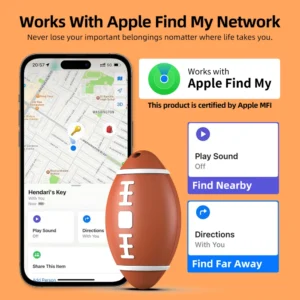
Consumer Electronics: Precise interaction and device tracking: Apple’s U1 chip in the iPhone 15 and Apple Watch Ultra 2, support for“Precision Finding”-when looking for a lost AirTag (UWB tracker, $29) , the phone’s screen shows the exact direction and distance of the AirTag (e.g. “2 meters ahead, 10 degrees to the left”) to within 20 centimeters. Apple reported in 2024 that the Precision Finding feature of UWB increased the success rate of retrieving lost items from 60% to 92%
Auto industry: keyless entry and self-driving: Ford’s F-150 Lightning electric pickup truck, introduced in 2024, supports UWB keyless entry-the owner carries a UWB-enabled phone within 1 meter of the vehicle, the vehicle will unlock itself automatically, and UWB is used for“Ambient awareness” of autonomous driving, helping the vehicle to identify the precise location of nearby pedestrians and bicycles to within 30 cm, improving autonomous driving safety. Ford said the technology had reduced the rate of false keyless entry from 0.1 per cent to 0.001 per cent
Industry: high-precision device tracking: Amazon has deployed a UWB positioning system in its Kentucky Logistics Warehouse, for tracking AGV robots and shelves — each robot and shelf is fitted with UWB tags (about $30 each) , and a UWB anchor is installed on top of the warehouse (about $150 each) , positioning accuracy within 20 cm, to ensure efficient movement of robots in dense shelves, to avoid collision. The system improves the efficiency of warehouse robots by 30% and reduces collision accidents by 85%
Health care: Patients and devices location: Johns Hopkins Hospital introduced UWB location in 2024, for tracking patients in the intensive-care unit (ICU) and medical devices (e.g. ventilators, defibrillators)-patients wear UWB bracelets (waterproof, low-power, seven-day battery life) with UWB tags, the tablet APP allows staff to see in real time where the patient is in the ICU (e.g. “Bed No. 3, moving to examination room”) and where the equipment is stored, with an accuracy of 15 cm or less. The system reduces staff time to find equipment by one hour per day and improves patient transport efficiency by 25 per cent.
5.3 UWB limitations and market challenges
Despite its extreme accuracy, UWB currently faces three major challenges-high cost, short range, and device compatibility-that limit its widespread adoption:
High Cost: UWB chips and devices are far more expensive than other location technologies — a single UWB chip costs about $5 to $10(Bluetooth chips cost just $0.5 to $1) , uWB anchors can cost $100 to $200(BLE beacons are only $15 to $30) . A smartphone that supports UWB costs $8 to $15 more in hardware than a smartphone that doesn’t, which is why some mid-and low-end phones still don’t support UWB; for example, in 2024, only 45% of smartphones in the U.S. market supported UWB, most of them are priced above $600(the iPhone 15, the Samsung Galaxy S24)
Short Range: UWB signals usually have a radius of less than 100 meters and are easily weakened by walls and metal barriers-UWB signals are almost impossible to penetrate on different floors of an office building, you’ll need separate anchors on each floor. For example, to achieve full UWB coverage in a 10-story office building in the United States, more than 200 anchors would need to be deployed, at a total cost of about $30,000, much higher than the cost of deploying Wi-Fi or Bluetooth
Lack of compatibility: there are several technical standards for UWB (e.g. Apple’s U1 chip, NXP’s UWB solution) , and there may be compatibility issues between devices from different vendors. Apple’s AirTag, for example, can’t accurately interact with Samsung’s UWB phones, so users who use different brands of devices may not get the full benefits of UWB. The 2024 Consumer Technology Association (CTA) called on the industry to develop a unified UWB standard to address compatibility issues.
A comprehensive comparison of GPS and other positioning technologies
To show the differences between GPS and other positioning technologies more clearly, the following table combines actual data from the US market (accuracy, cost, application cases) and compares them in seven core dimensions:
| Location Technology | Range of accuracy | Coverage | Power levels | Equipment/deployment costs | Core dependencies | A typical case of American application | Anti-jamming capabilities |
| GPS | Outdoor 3-10 meters; high accuracy 10 cm | Global (unobstructed area) | High (4-5 hours of cell phone navigation) | The receiver costs $2-$5(integrated phone) ; high-resolution devices cost $2,000-$5,000 | Satellite signal (at least 4) | Waze navigation, Amazon truck tracking, Garmin outdoor watch | Strong |
| Cellular location | 30-150m in urban areas; 300m-1km in rural areas | Carrier base station coverage (97% of U.S. territory) | Medium (10-12 hours standby) | No additional device costs; $4.99 per device/month for enterprise service | Mobile network signal (at least 1 base station) | E911 emergency services, T-Mobile home location, John Deere farm tracking | Medium |
| WI-FI location | 10-20 meters in hot spots; 50m + in sparse areas | WI-FI hotspot coverage (85% of U.S. population) | Low (12-14 hours standby) | No additional device costs; $0.50-$1/M2 for enterprise deployment | WI-FI hotspots (at least 3 scannable) | Wal-mart in-house promotions, Atlanta Airport Navigation, Microsoft headquarters location | Weak |
| Bluetooth (BLE) | Normal 1-5m; AOA/AOD 0.5-2m | 10-30 m (single beacon) | Extremely low (beacons last 1-2 years) | Beacons cost $15-$30 per unit; $1,000-$3,000 per store deployment | Ble beacons (at least 3) | Starbucks personalized marketing, Tesla factory parts tracking, New York subway accessibility | Medium |
| UWB | 10-30 cm | ≤100 m (single anchor) | Medium (cell phone standby 8-10 h) | Chips cost $5-10; anchors $100-200 | UWB anchors/tags (at least 3) | Apple Precision Finding, Ford UWB keyless entry, Amazon warehouse robots | 强 |
Conclusion: the“Collaborative Era” and future trends of location technology
Through in-depth analysis of GPS and other positioning technologies, it can be found that GPS is still the“Core technology” of outdoor global positioning in the united statesーー in scenes such as highway navigation, interstate logistics tracking, and wilderness rescue, etc. , its advantages of global coverage and outdoor high-precision are irreplaceable, but in indoor, underground or dense urban environments, cellular networks, Wi-Fi, Bluetooth, UWB and other technologies have become“Key complements” to GPS, together, they constitute a“Full-scene positioning system”.
Today, “Hybrid positioning systems” are common in mainstream devices in the U.S. : Apple’s iPhone, for example, uses a combination of GPS + A-GPS with an accuracy of 3-5 meters outdoors Once inside the store, switch to Wi-Fi + Bluetooth, with an accuracy of 10-20 meters. When there is no GPS or WI-FI in the basement, switch to cellular network positioning, with an accuracy of 50-100 meters. When the user looks for an AirTag, UWB is activated, to within 20 centimeters. According to Google Maps’ 2024 report, this hybrid positioning mode increased the positioning success rate from 75% to 99% , and the average accuracy by 40% .
In the future, there will be three trends in the development of location technology in the United States:
AI-driven intelligent switching: automatically selecting the optimal combination of positioning technologies by analyzing environmental characteristics (such as satellite signal strength, WI-FI hotspot density) through machine learning algorithms. For example, the AI location algorithm developed by the US start-up company Pointr can judge the scene and switch technologies within 0.1 seconds, improving the indoor positioning accuracy to less than 2 meters, and has been adopted by 10 airports in the United States
Balance between location and privacy protection: with the wide application of location data, privacy protection becomes the key. Companies such as Apple and Google have rolled out ‘differential privacy’-anonymizing and obfuscating location data so that it can not be linked to a specific user. California’s revised 2024 CCPA law requires companies to obtain“Explicit authorization” from users before collecting location data, and users can delete data at any time
The mass adoption of UWB: as chip costs fall (projected to drop to $2-$3 by 2026) and Standards Converge, UWB will move from high-end devices to mid-to low-end devices. According to Grand View Research, more than 70% of smartphones in the US will support UWB by 2026, tripling its use in industrial and medical applications and making it the dominant technology for high-precision positioning.
For U.S. consumers and businesses, the core principle for choosing location-based technology is“Scene matching”: GPS for outdoor long-distance navigation, cellular for emergency calls, Bluetooth for mall marketing, Wi-Fi for indoor navigation, uWB is the choice for high-precision tracking-and the future location experience will be a seamless“Senseless service” where users can enjoy accurate and reliable location support in any scenario.

