Introduction: the“Invisible Rule” of GPS in life
When you’re driving along California’s Route 1 between the cliffs of the coast, when UPS trucks pull up to customers’ doors on the streets of Queens, New York, when farmers in Iowa plant their soybeans using a tractor’s navigation system, they rely on the global positioning system (GPS) behind the scenes. Developed by the US Defence Department and now serving the global civil and commercial sector, GPS has penetrated deep into every corner of the US economy. According to the United States Department of Commerce in 2024, GPS-related industries contribute about $1.2 trillion to the U.S. gross domestic product each year and create 5 million jobs, ranging from the location of car-hailing apps on mobile phones to the ocean-going voyages of aircraft carriers, this is a“Space compass”.
![]()
But it’s not uncommon for American users to get confused when navigating through the dense skyscrapers of Manhattan on your phone suddenly leads you to the wrong intersection; when hiking in the Colorado Rockies, gPS elevations differ by tens of metres; in the tunnels of the San Francisco ⁇ Oakland Bay Bridge, navigation can even be“Lost”. The core of these questions, all point to a key question: How Many satellites does GPS positioning need to ensure accuracy? Why is it that sometimes 3 satellites can tell you where you are, and sometimes 10 can be off? In this paper, the deep relationship between GPS positioning and the number of satellites will be comprehensively analyzed from the principle to practice, combined with the technical application and practical cases of the United States.
First, the“Space skeleton” of GPS system: satellite constellation design and signal basis
To understand the impact of satellite number on accuracy, we first need to understand the basic structure of a GPS system. GPS is not a single satellite, but a“Constellation Network” of 24 working satellites plus six standby satellites spread evenly across six near-circular orbital planes (each with an inclination of 55 °) , orbiting at an altitude of about 20,200 km, each satellite orbits the earth for about 12 hours. The core purpose of this design is to ensure that at any time, anywhere on the globe, at least four or more satellites — a core standard set by the U.S. Air Force when the system was fully deployed in 1994.
The“Signal language” of GPS satellites
Each GPS satellite continuously sends two key signals to Earth: L1(1575.42 mhz-RRB- L2d l2(1227.60 mhz) . The L 1 signal is mainly used for civil navigation, ordinary mobile phones and vehicle navigation devices rely on this frequency band; the L 2 signal is oriented to high-precision demand scenarios, such as surveying, agriculture and military, and requires a dedicated receiver to interpret. Starting in 2018, the United States began the deployment of a new generation of GPS III satellites, adding a new L-5 band (1,176.45 mhz) with a 10-fold increase in anti-jamming capability and a 50 percent improvement in positioning accuracy over older satellites.
![]()
II. The logic of GPS: Why Four Satellites is the bottom line?
The essence of GPS positioning is“Calculating the distance from a satellite signal,” but this process is far more complicated than“Measuring a straight line between two points,” because the satellite and receiver clocks are out of sync, and the Earth’s environment distorts the signal’s path. To understand how many satellites are needed, you have to dismantle the technology.
2.1 pseudo-range measurements: GPS“Range calculation”
GPS satellites contain two key pieces of information in their signals: the precise location of the satellite (known as“Ephemeris Data”, which is set in advance by ground stations) and the time at which the signal was sent (recorded by atomic clocks on the satellite, to within a nanosecond a day) . After receiving the signal, the receiver records the“Time of reception” with its own quartz clock, multiplying the difference between the“Time of transmission and time of reception” by the speed of light (300,000 km/s) , calculate the“Pseudo-range” with the satellite (so called because the receiver clock is out of step with the satellite’s atomic clock, so the calculated distance is not the true value) .
2.2 mathematical pitfalls of trilateration
In theory, you can determine a position by“Knowing the distance to three satellites”-each satellite corresponds to a sphere“With the satellite at its center and the pseudorange at its radius.” The intersection of these spheres creates two points of intersection, by eliminating unreasonable points of intersection inside the Earth or in space, two-dimensional coordinates (latitude and longitude) can be obtained. But in practice, this“Theory” would be completely invalidated by clock errors.
The quartz clock on a typical GPS receiver can be off by a millisecond a day, which translates to a distance error of 300 kilometers (1 millisecond by 300,000 kilometers per second) — enough to get you from New York to Boston. Therefore, a fourth satellite must be introduced: by comparing the pseudo-range differences of the four satellites, the error value of the receiver clock is calculated in reverse, and then this error is used to correct all pseudo-ranges, finally, the precise three-dimensional coordinates (longitude, latitude and altitude) are obtained. That’s why the U.S. Federal Aviation Administration (FAA) has made it clear that all civil aviation GPS devices must be able to receive signals from more than four satellites at a time, or they’re banned from being used for flight navigation.
2.3“Practical limitations” of two-dimensional localization
Some readers may ask: “When I turn off the altitude display on my phone, will three satellites be enough?” In theory, yes, but few devices do that in practice. Take the early U.S. Garmin Nuvi 200 in-car navigator (introduced in 2007 and priced at $199.99) , which supports“Two-dimensional positioning only” mode, when only three satellites are available, the navigator displays latitude and longitude with an error of 50 to 80 meters in altitude — meaning that in mountainous areas, you may think you’re on a highway, but you’re actually at the edge of a cliff. That’s why, since 2010, every consumer GPS device on the U.S. market has turned off“Two-dimensional positioning only” by default, requiring at least four satellites to signal.
3. The“Stealth killer” that affects the number of satellites and positioning accuracy
Even if the equipment can receive four satellites, the positioning accuracy can still be deviated from 1 meter to 100 meters, which is due to a combination of environmental and technical factors. In different regions and different scenarios in the United States, the influence of these factors varies significantly.
3.1 number of visible satellites: “Signal Gap” from Hawaii to Alaska
The orbit design of GPS satellites ensures global coverage, but the“Visible number” varies by geographic location. In the continental United States (30 °-45 ° N) , open terrain (such as the plains of Kansas) can receive 7-12 satellites at any one time; in Hawaii (20 ° N) , satellite coverage is denser because of its proximity to the equator, the number of visible satellites can reach 8-14, while in Alaska (above 60 ° N) , the number of visible satellites at high latitudes is reduced to 5-8 due to the satellite orbit inclination of only 55 ° , and is mostly concentrated in the southern part of the sky, poor geometric distribution.
Tests conducted by the United States Geological Survey (USGS) near the Arctic Circle in Alaska in 2023 showed that the number of visible satellites was further reduced to 4-6 during the winter polar night due to the enhanced atmospheric refraction effect, positioning accuracy decreased from 10 m to 25 m, this has been a major problem for polar expeditions monitoring the ice cap — they have to carry $25,000 worth of high-precision GPS receivers (cell phone GPS costs just $5) , to keep the data valid.
3.2 urban canyon: Manhattan’s“Signal Maze”
In New York’s Manhattan, Chicago Loop and other high-rise areas, GPS signals will be more than 300 meters high-rise buildings block, reflection, the formation of“Urban Canyon effect.”. According to a 2024 study by New York University, only three to five satellites can be picked up by a mobile phone on Manhattan’s Fifth Avenue, which is flanked by buildings more than 40 storeys high, mostly from directly above the sky (elevation greater than 60 °) , the geometric distribution of satellites is extremely poor -GDOPGDOP = 5.0, GDOP is the“Geometric dilution of precision”, the smaller the value, the higher the accuracy, the ideal value is 1.0-2.0) .
In this case, the positioning error is often 15-30 meters — you see yourself on your phone at Fifth Avenue and 50th Street, but you’re probably already at 51st Street. To address this problem, the New York City Department of Transportation invested $12 million in 2022 to install“GPS-enhanced beacons” at 200 key intersections in Manhattan, using Bluetooth signals to help correct their location, by narrowing the margin of error to 5-8 meters, taxi drivers reported a 28 percent drop in detour complaints.
3.3 natural shelter: blind spots in tunnels and forests
The tunnel: America’s longest road tunnel, the San Francisco ⁇ Oakland Bay Bridge Tunnel (2.7 km) , is a classic GPS“Black hole”. After the vehicle entered the tunnel, the satellite signal completely disappeared within 10 seconds, ordinary mobile phone navigation will immediately“Crash”. To this end, the California Department of Transportation has installed an inertial navigation system (INS) inside the tunnel. In conjunction with radio frequency identification (RFID) tags on the walls of the tunnel, vehicles can use the INS to calculate their position as they pass, with an error of no more than 10 meters, to ensure uninterrupted navigation. The system costs $8.5 million to build and about $400,000 a year to maintain, but the California Department of Transportation estimates that it could reduce the number of accidents caused by navigational disruptions by 15 a year, about $3 million in rescue and compensation costs.
Forest: in the temperate rain forest of Washington’s Olympic National Park (trees 30-50 meters high, with a canopy of more than 90 percent) , GPS signals are obscured and scattered by dense foliage. Test data from the National Park Service (NPS) shows that hikers’ phones can only pick up four to six satellites in the forest, with an accuracy of 20 to 35 metres, compared with 5 to 10 metres in open terrain. As a result, NPS is handing out free paper maps at the entrance to the park and reminding visitors: “Even if you carry a GPS device, use it with a compass to avoid getting lost in the forest.” 2023, there were 12 incidents of people getting lost due to GPS errors in the park, eight of which were caused by tourists relying too heavily on their mobile phones and ignoring the impact of the environment on the signal.
3.4 atmospheric interference: ‘Distorted Signals’ from the sun and clouds
GPS signals travel from satellites (in space) to the ground through the ionosphere (60-1000 km above sea level) and troposphere (0-18 km above sea level) , which cause delays and errors.
Ionospheric interference: Electrons in the ionosphere absorb and reflect GPS signals, especially during periods of intense solar activity (e.g. , solar flares, sunspots) when the electron density increases sharply, the signal delay can be within 5-10 meters. NASA has a dedicated ionospheric monitoring station at the Kennedy Space Center in Florida that calculates ionospheric delays in real time, and through the“Klobuchar Model”(a universal ionospheric correction algorithm) to the public free of charge correction data. Ordinary mobile phone GPS by receiving this data, can reduce the ionosphere error 70% , accuracy to 3-5 meters. During a solar flare in April 2024, a GPS device that was not turned on had an error of 15 meters in the California area, while the device that was turned on had an error of only 3 meters.
Tropospheric interference: changes in water vapor and temperature in the troposphere can change the refractive index of the air, causing the speed of the signal to deviate from the speed of light, usually by 1-3 meters, but in heavy rain, high temperature and high humidity environment will increase to 5-8 meters. The National Oceanic and Atmospheric Administration (NOAA) has a tropospheric monitoring network in Houston, Texas (covering 10 southern states) that updates tropospheric delay data hourly. U.S. agricultural drone company Precisionhawk’s plant protection drone ($35,000) will tap into this data during Texas summer (35-40 °C, more than 80% humidity) field operations, positioning accuracy from 10 meters to 2 meters, to ensure that pesticide spraying is not omitted, not repeated, per acre of farmland to save pesticide cost about 12 U. S. dollars.
3.5 multipath effect: the location trap of“Reflected signals”
When a GPS signal bounces off buildings, ground, and water, it reaches the receiver at the same time as the direct signal, causing the receiver to calculate the wrong pseudorange — a phenomenon known as multipath effect, it’s also one of the main sources of positioning errors in cities.
The multipath effect is particularly pronounced in Las Vegas’ casino-hotel complex (Bellagio, Venetian, glass-walled) . According to a 2023 test by the University of Nevada, up to 40 percent of reflected signals are received by cell phones in the plaza outside hotel lobbies, the positioning error is 8-15 meters-you see yourself on your phone in front of the Bellagio, but you’re probably in front of the Paris Hotel next door. To address this problem, the Las Vegas City Hall invested $5 million in 2024 to install“Multipath suppression beacons” at 20 popular attractions, which cancel out reflection interference by transmitting signals at specific frequencies, the positioning error was reduced to 3-5 meters, and tourists’ navigation satisfaction increased by 42% .
Another typical scene is The Grove Mall in Los Angeles (120,000 square meters of open-air parking surrounded by 3-to 5-story commercial buildings) . Parking billboards, streetlights will reflect the GPS signal, resulting in vehicle positioning error of 10-20 meters, the owner often can not find their parking position. To this end, the shopping mall introduced a“GPS + Bluetooth” dual-mode positioning system in 2023, installing 800 bluetooth beacons in the parking lot, and vehicles receive both GPS and Bluetooth signals through mobile phones, which can be used to track the location of vehicles, the positioning accuracy was improved to 2-3 meters, the vehicle owner’s search time was shortened from an average of 15 minutes to 3 minutes, and the turnover rate of the parking lot was increased by 18% .
Fourth, the number of satellites and positioning accuracy of the“Quantitative relationship”: from four to 12 differences
The number of satellites directly affects positioning accuracy, but not“More is better”– it depends on the distribution of satellites (GDOP values) and the requirements of the application scenario. Based on the actual cases of the United States, the accuracy levels and application scenarios corresponding to different satellite numbers are analyzed.
![]()
4.14 satellites: “Usable but not good enough” basic positioning
When the equipment can only receive four satellites, it can achieve basic three-dimensional positioning, but the accuracy is usually 10-15 meters, and poor stability (if one satellite signal is interrupted, positioning immediately failed) . This is most common in remote areas of the United States, such as ranches in Wyoming (thousands of acres with a population density of 0.6 people per square kilometer) .
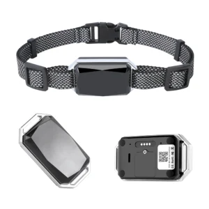
Wyoming rancher Tom Wilson, who owns a 2,000-acre cattle ranch, has put GPS collars on 150 cows (each collar costs $199 and supports four satellites) , they’re used to track the location of the herd. “On open prairie, collars can show the general area of a herd, but sometimes they’re off by as much as 15 meters,” Wilson said, “I once looked for a lost cow by GPS, and after looking around for half an hour, I found it by a stream 10 metres away.” But it is still three times more efficient than traditional horseback riding and saves Wilson about $12,000 a year in labour costs.
4.25-6 satellites: ‘Stable Enough’ for civilian positioning
When the number of satellites is increased to 5-6, the positioning accuracy is improved to 5-10 meters, and the stability is significantly improved (even if one satellite signal is interrupted, there are still four satellites available) , this is the“Mainstream demand” of most civilian scenarios in the United States, such as suburban logistics distribution, road navigation, etc. .
UPS’ “Orion” routing system is a prime example of this satellite-count application. The Orion system relies on GPS devices in each delivery vehicle (five or six satellites) , combined with real-time traffic data, to plan optimal routes. UPS data shows that when a vehicle can stably receive five or six satellites, the positioning accuracy is maintained at 5-8 metres, enough to ensure that the vehicle is accurately parked at the customer’s door and the route planning error is reduced by 15 per cent. In 2023, Orion saved UPS 30 million gallons of fuel, or about $105 million in cost savings based on an average U.S. fuel price of $3.50 a gallon, 360,000 tons of carbon emissions.
4.37-8 satellites: ‘high-precision’ urban and commercial positioning
7-8 satellites can achieve a positioning accuracy of 3-8 meters, and the satellite distribution is more uniform (GDOP value 1.5-2.5) , which is suitable for scenarios with high accuracy requirements, such as urban ride-hailing and commercial distribution.
Uber, an American ride-hailing platform, operates in cities such as Los Angeles and Miami, requiring drivers’ phones to receive 7-8 satellites reliably. Uber’s technical report shows that when the number of satellites reaches seven or more, the positioning error of the“Passenger pick-up point” received by drivers is reduced from 10 meters to 3-5 meters, and passengers’ waiting time is reduced by an average of 1.2 minutes, complaints about location errors fell by 15% . “In downtown L.A. , it used to be that I couldn’t find my passengers at the same intersection because of bad GPS,” said Mario Rodriguez, an Uber driver, “Now that there are enough satellites, I can drive directly in front of passengers and get two or three more a day.”
4.410 + satellites: “Sub-meter” professional positioning
When the number of satellites is more than 10(usually GPS + GLONASS + Galileo multi-system combination) , the positioning accuracy can reach 0.5-1 m (sub-meter level) , which is suitable for professional scenarios such as precision agriculture, surveying and mapping, and engineering construction.
Iowa soybean farmer Mark Anderson owns a 1,000-acre farm, and his planter is equipped with a navigation system that supports 12 satellites (GPS + GLONASS-RRB-(the equipment costs $8,000) , with Differential GPS -DGPS-RRB-GPS) corrections, the accuracy is 0.5 meters. “Row spacing errors must be limited to 10 centimeters or they will affect photosynthesis and yield,” Anderson said, “With more than 10 satellites, I don’t need a manual line-up, the planter keeps going in a straight line, and I get five more bushels per acre.” At an average price of $15 a bushel in the US, anderson’s farm earns an additional $75,000 a year and pays for its equipment in one growing season.
According to a 2023 survey by the United States Department of Agriculture (USDA) , 68 percent of large farms in the United States (more than 500 acres) have adopted high-precision GPS with“More than 10 satellites plus differential technology.” Average yields on these farms are 8-10% higher than on conventional farms, fertiliser and pesticide use is 15-20% lower, and net profit per acre is $50-80 higher.
5. “Technology combos” to improve GPS accuracy: innovative applications in the United States
Increasing the number of satellites alone can not meet the accuracy requirements of all scenarios. Through a variety of technological innovations, US companies and agencies have further broken through the limits of GPS accuracy, moving from“Meter level” to“Centimeter level”.
5.1 auxiliary GPS -A-GPS-RRB-GPS) : solving the pain point of“Slow first positioning”
Ordinary GPS devices need 5-10 minutes to find enough satellites and complete positioning when they are cold-started (e.g. after a long shutdown) , a-GPS uses cellular networks, such as at & T’s and Verizon’s 4G/5G networks, to get satellite ephemeris and time in advance, shortening the time to first fix to 30 Seconds-1 minute.
The U.S. mobile operator T-Mobile launched an“Enhanced A-GPS service” in 2022 for rural areas, where cellular coverage is weak, t-Mobile boosted the success rate of GPS positioning for rural users from 60% to 95% by sending auxiliary information over a low-bandwidth data transfer (just 2KB/s) . The service, which costs $1.99 a month, has more than 2 million rural subscribers. “In rural Kansas, my phone used to fail to locate in a cornfield,” farmer John Miller said, “Now with A-GPS, even in fields where the corn is taller than a person, I can quickly locate it so I can record the irrigation with my phone.”
5.2 multi-system integration: GPS + GLONASS + Galileo
U.S. consumer electronics and automotive companies generally support multi-satellite systems for joint positioning, increasing the number of visible satellites by simultaneously receiving signals from GPS (U.S.) , GLONASS (Russia) , and Galileo (Europe) , improving accuracy and stability.
Apple’s iPhone 15pro (which starts at $999) supports GPS + GLONASS + Galileo + Beidou (China) . In tests in Manhattan, New York, it was able to receive four to five satellites with an error of 15 to 20 meters when relying solely on GPS With multiple systems enabled, it can receive 8-10 satellites with an error margin of 5-8 meters. According to Apple’s user research, users using multi-system navigation spend an average of 20 per cent less time finding their way around a city and experience a 40 per cent drop in navigation errors.
US car rental company Hertz has installed multi-system navigators in 100,000 of its leased cars, such as the Ford F-150 and Toyota Camry, according to its 2023 customer report, customer satisfaction with multi-system navigation increased by 18% compared to single GPS, and the number of complaints due to navigation errors decreased by 22% . “In Chicago’s Loop district, customers used to call and say the navigation was leading them to a dead end,” says Sarah Jones, Hertz’s Chicago branch manager, “Now that multi-system navigation has solved that problem, we’ve had a lot less negative customer feedback.”
For the aviation industry, multi-system integration is the key to“Safe backup”. The U.S. Federal Aviation Administration (FAA-RRB- formally approved GALILEOileo system as a backupGPS GPS in 2024, and U.S.u.s, all U.S. commercial airlines, including American and delta, will be required to upgrade their navigation systems to support GPS PLUS Galileo by 2025. The FAA calculates that the move could cut the rate of flight delays caused by GPS outages from 0.8 per cent to 0.1 per cent, saving the US airline industry about $50m a year in delays.
5.3 differential GPS (DGPS) : “Error correction” for ground stations
DGPS works out the error value of the satellite signal by receiving it from a ground station at a known precise location (within one centimetre) , this correction is then transmitted by radio or network to a nearby GPS receiver, improving the receiver’s accuracy from 10 metres to 1-3 metres.
The United States Coast Guard (USCG) has established a network of 200 DGPS base stations covering the United States coastal areas and major inland waterways to provide free DGPS signals to the public, used primarily for ship navigation, port operations, and coastal fisheries. The container cranes at the port of Los Angeles rely on DGPS for positioning to an accuracy of 1-2 meters to ensure that containers can be accurately lifted onto trucks or ships. According to the port of Los Angeles, the use of DGPS has increased the efficiency of cranes by 10 per cent, reduced container damage from 0.5 per cent to 0.1 per cent and saved about $2m a year in maintenance costs.
![]()
DGPS are also widely used in agricultural areas in the American interior. The Iowa Department of Agriculture has built 50 DGPS base stations in the state, covering 90 percent of the state’s farmland, and farmers can receive the correction signal free of charge by buying a DGPS-enabled receiver (about $2,000) . “When I didn’t have DGPS, my planter would miss 5 meters and waste a lot of land,” said Anderson, a soybean farmer in the state. “With DGPS, I can grow 500 more plants per acre and increase yields by 10 percent with a meter error.”
5.4 RTK technology: the ultimate solution for“Centimeter-level” accuracy
Real-time kinematic positioning (RTK) is currently the most accurate GPS technology, through real-time data transmission (usually through 4G/5G networks) between ground base stations and mobile stations (such as mapping equipment, unmanned aerial vehicles) , the positioning accuracy is improved to 2-5 cm, which is suitable for high-end scenarios such as surveying and mapping, engineering construction, and precision agriculture.
Trimble’s RTK mapper (model R 2, $12,000) is widely used in U.S. highway construction projects. In the I-35 extension project in Texas, the construction team used Trimble R 2 to map the terrain to an accuracy of 3 cm, which is 50% more efficient than traditional mapping methods (accuracy of 1 m) . Mike Davis, an engineer working on the project, said: “Traditionally, it took a team of five people two weeks to complete a 10km stretch of road. Now, with RTK, a team of two people can do it in three days, saving 80 per cent of the labour costs.” 10% reduction in time and 8% reduction in cost, saving about $2 million.
In agriculture, DJI Innovation (DJI’s U.S. subsidiary) has launched an agricultural plant protection drone (model T40, $15,000) equipped with an RTK module ($800) , positioning accuracy of up to 2 cm, can be accurately sprayed along the crop line to avoid duplication or omission. California vineyard owner David Cohen, who owns a 500-acre vineyard, used a T-40 drone to spray pesticides, cutting his use from five gallons per acre to four gallons (a 20 percent savings) , the cost savings are about $30 per acre, for a total of $15,000 a year. “The spacing of the vines is only 1.5 meters,” Cohen said. “It used to be that spraying by hand would get into the aisles, waste pesticides and pollute the environment.” “The RTK can be sprayed precisely on vines, saving money and reducing soil pollution.”
Conclusion: the“Law of satellite numbers” and future trends in GPS positioning
Through the analysis of the principle of GPS, the number of satellite requirements and the application cases in the United States, we can summarize the“Core law” of GPS positioning:
Four satellites are the“Bottom line”: basic three-dimensional positioning (10-15m accuracy) , suitable for rough tracking in remote areas (such as locating cattle in pastures) ;
5-8 satellites are“Mainstream”: meeting civilian scenarios (3-10 meters accuracy) , such as logistics distribution, urban navigation, is the goal of most U. S. consumer devices;
More than 10 satellites + technical assistance is“High-end”: through multi-system integration, DGPS/RTK technology, sub-meter to centimeter-level accuracy is achieved, supporting precision agriculture, surveying, mapping, aviation and other professional fields;
Satellite number ≠ Accuracy: satellite geometry (GDOP value) , environmental occlusion, atmospheric interference and other factors are also critical. In Manhattan, New York, 10 satellites may not be as accurate as the six on the Alaska Prairie.
In the future, with the full deployment of U.S. GPS III satellites (24 by 2025) , the integration of 5G networks with GPS, and the need to upgrade scenarios such as autonomous driving and smart cities, the U.S, GPS positioning will be developed in the direction of“Higher accuracy, lower delay and stronger anti-interference”. Tesla’s Autopilot system, for example, has begun testing“GPS III + LIDAR” fusion positioning to within 10 centimeters to ensure safe driving on highways The city of Chicago plans to spend $50 million by 2025 to build a“Smart city GPS network” that will enable positioning within the city to generally reach 1-2 meters by installing 1,000 enhanced base stations across the city, for smart parking, traffic control and emergency rescue.
For U. S. users, GPS is no longer a simple“Navigation tool”, but support life, work, industrial development“Infrastructure”. Understanding the relationship between the number of satellites and positioning accuracy can not only help us better use of GPS equipment, it also shows the technological innovation and economic value behind the technology, which has evolved from a military technology to a $1.2 trillion-a-year“Economic engine” since it was fully deployed in 1994, and the possibilities are endless.

