How GPS Tracker works: a complete explanation of the process from satellite to client
GPS trackers have penetrated every aspect of our lives — from pet collars and sports watches to car burglaries, logistics tracking and even polar research equipment. Its core is“Precise positioning + data delivery”, but there is an interlocking technological process from satellite signals to“Real-time location” on users’ mobile apps. Let’s break it down step by step, combining hardware details, environmental impacts, and actual scenarios to make the principle clearer.
![]()
The core hardware of a GPS tracker: the“Basic skeleton” of location and transmission
Before we understand the process, we need to understand the core components of the tracker-the hardware that will enable the location:
GPS receiver chip: the core of the core, responsible for the acquisition of satellite signals, ephemeris data (satellite orbit information) . Common brands such as u-blox (high-precision scene) , MTK (cost-effective civilian) , Qualcomm (integrated communication function) , chip performance directly determines the positioning speed and accuracy.
![]()
Multi-mode positioning antennas: there are“GPS ceramic antennas”(to receive satellite signals, pointing skywards) and“Communication antennas”(to transmit data, such as 4G/NB-IoT antennas) . Some devices have antenna gain optimization, reduced occlusion interference.
Processor (MCU/CPU) : the“Brain” that processes raw coordinates, computes speed/direction/dwell states, and fuses data from multiple satellite systems.
Data transmission module: real-time equipment with SIM/eSIM card slot + Cellular Module (2G/4G/NB-IOT) , satellite equipment with satellite communication module, off-line is not this module.
Storage Media: offline devices have built-in Flash (small capacity) or SD cards (large capacity, such as 8 GB for a year’s track) , and real-time devices also store data temporarily in case of network outages.
Power modules: lithium-ion batteries for portable devices (low-power electronics for extended battery life, such as a pet collar for 14 days plus) , and rechargeable batteries for on-board devices (7 days plus after power outage) .
Step 1: receive the satellite signal-a key step in determining where I am
The essence of GPS tracker positioning is“Calculating the distance from the satellite signal”. This step needs to solve two problems: “Receiving enough satellites” and“Calculating the position”.
1. “Capture conditions” for satellite signals
How many satellites and why four?
GPS positioning relies on“Time difference positioning”: the distance between the satellite and the tracker = the speed of light x the time the signal travels (the difference between the time stamp of the satellite’s atomic clock and the local time of the tracker) .
![]()
3 satellites: can only calculate two-dimensional coordinates (longitude + latitude) , but there is a“Time error”(the tracker clock is not as accurate as the satellite atomic clock) , and can not determine altitude;
Satellite 4: the core role is to calibrate the time error, while calculating the three-dimensional coordinates (longitude + latitude + altitude) to ensure accurate positioning.
In practical application, the tracker will preferentially capture 6-8 satellites (multi-satellite redundancy) to further improve the accuracy.
Satellite options: more than GPS
Today’s mainstream trackers support“Multi-satellite positioning”(GNSS multi-mode) , or receiving signals from multiple global navigation satellite systems at once, rather than relying solely on US GPS:
| Satellite navigation system | Home region | Core Strengths | Open environment precision |
| GPS | United States | Reach and sophistication | 2-5m |
| Beidou (BDS) | China | Short message support, strong signal at high altitude | 1-3 meters |
| GLONASS | Russia | Anti-blocking in urban canyons | 3-8 meters |
| Galileo | European Union | High accuracy and safety for civilian use | 1-4 meters |
| Benefits of multi-satellite integration: in high-rise dense“Urban canyon” or forest, single GPS may receive only 2 satellites, multimode can receive 4-5, to avoid positioning interruption. |
2. “Environmental impacts” of signal reception
Ideal Scene (open outdoor) : positioning accuracy 2-5 meters, fast positioning speed (hot start < 10 seconds, cold start < 30 seconds) ;
Complex scene (indoor/high-rise/Tunnel) : satellite signal is reflected or blocked, resulting in“Multipath effect”, the accuracy is reduced to 10-20 meters, even positioning failure (this time will switch to“Base station positioning (LBS)” supplement, accuracy 100-500 meters) ;
Electromagnetic interference (high voltage/strong magnetic field) : interferes with chip signal acquisition and requires optimization of antenna layout (E. G. car trackers with antenna mounted on roof) .
Step 2: location data processing-turning“Latitude and longitude” into“Useful information”
The raw data output by the GPS chip is in“NMEA protocol format”(e.g. $GPGGA, 123519.000,3954.6562, N, 11623.3852, E, 1,08,0.9,73.7, M, -9.2, m, , * 6d) , this step requires the processor to“Translate” and process the data.
![]()
1. Core data content
Coordinate transformation: the original latitude and longitude (such as“39 ° 54′39.37′ N, 116 ° 23′23.11′ E”) is transformed into the map can be recognized“Point coordinates”, for subsequent display on the App;
Calculation of derived information:
Speed: the difference in distance and time between passing two points (e.g. moving 300 meters in 10 seconds, speed = 108 km/h) ;
Heading angle: determine the direction of movement (e. g. “30 ° east of due north”) ;
Status of stay: constant for 5 minutes → judged as“Stay”, record time/place of stay (e.g. car tracker records“1.5 hours in mall car park”) ;
Multi-data fusion: if the equipment with sensors (such as temperature and humidity sensors, accelerometer) , it packs“Location + temperature + movement”(e.g. , logistics container tracker: “Latitude and longitude XXX, container temperature 25 °C, no vibration”) .
2. “Optimisation” of multi-satellite data
The processor“Cross-checks” signals from multiple systems, such as GPS and Beidou. For example, GPS calculates a latitude of 39.91 degrees, Beidou calculates 39.92 degrees, and the processor takes an average of 39.915 degrees, at the same time, the abnormal data (such as the deviation caused by the weak signal of a satellite) is eliminated, and the accuracy in complex environment is improved to 5-10 meters (better than 10-20 meters of single GPS) .
Step 3: data storage or transfer-“Live upload” or“Post-export”?
The“Tracking” function of the tracker is essentially to“Let the user get the location data”, which is divided into two core modes: real-time transmission and offline recording. Some professional equipment supports satellite transmission.
1. Real-time transmission (most popular, 80% of civilian market +)
Suitable for“At any time monitoring” scenarios (car, pet, elderly care) , the core is“Cellular Network + Cloud Server”.
Transfer flow:
The Tracker’s built-in SIM/eSIM card connects to the cellular network (2G/4G/NB-IOT) ;
Upload the processed location data (about 1-5KB/bar) to a cloud server
The cloud server receives the data and“Stores it, parses it, and synchronizes it”-backing it up to a database (keeping track for 1-3 months) and pushing it to the user’s mobile App/Web in real time.
Network selection tips:
4G: suitable for real-time scenarios (such as vehicle tracking) , transmission frequency of 10-30 seconds/time, to ensure that the“Mobile App move”;
NB-IoT: suitable for low power consumption scenarios (e.g. pet collars, logistics tracking) , transfer frequency 5-10 minutes per trip, low data usage and long battery life (1-3 months per charge) .
2. Off-line (GPS Logger)
No network required, suitable for no signal scenarios (outdoor adventure, sports recording) , the core is“Local storage”.
Storage flow:
The processor writes location data directly to the built-in Flash or SD card
When the user returns to the Internet/computer environment, the data is exported via USB/Bluetooth (e.g. , the running watch is connected to the computer to export the running track)
Use software such as Google Earth or Garmin Connect to visualize the data and see the full trajectory.
Typical scenarios:
Running watch: record“Pace per kilometer + altitude change”, sync to the App afterwards to analyze the effect of exercise;
Outdoor adventure equipment: record route while climbing, save data when no signal, export back to camp.
3. Special Communications (satellite transmission, for off-grid areas only)
Suitable for marine, polar, desert and other non-cellular network scenarios (ocean-going ships, polar expeditions) , the core is the“Satellite communication module”.
Transmission features:
No dead space coverage: rely on low-orbit satellites (such as Iridium constellation 66 satellites) or geosynchronous satellites, the world can transmit;
Low Speed + high cost: can only transmit short data (such as“Latitude and longitude XXX, please help”) , can not transmit pictures/videos;
Typical scenarios: ocean-going cargo ship tracking (real-time reporting of location to prevent loss of contact) , mountaineering team emergency positioning (no signal to send a distress location) .
![]()
Step 4: users view location — from“Data” to“Intuitive experience.”
It’s the final step in the process, and it’s the most intuitive experience for the user-turning abstract data into“Visible, usable” information through mobile apps and the Web.
1. Core experience
Real-time monitoring: the App displays dynamic icons (e.g. , car, pet) that are updated as the tracker moves, and supports map switching (satellite, street view) , you can even see“Real-time speed”(e.g. , “Current speed: 60 km/h”)
Historical Track Replay: replay route by time period (e. g. “Today 9:00-18:00”) , mark critical points-red points (speeding points, e.g. “90 km/h at 10:30,60 km/h over the speed limit”) , blue points (stopping points, e.g. “Stop at restaurant between 12:00 and 13:30”) , it can also export tracks as Excel/CSV files (commonly used in corporate fleet management)
Geo-fence alerts: users draw a“Safe zone”(e.g. “500 meters from home”) on the App, and if the tracker exceeds the zone, the system immediately triggers an alarm-an App push + SMS alert (if the pet runs out of the safe zone, the owner receives“Your pet is 500 meters away from home, current location XXX”) ;
Multi-device management: one account can be tied to multiple trackers (e.g. , business management of 10 trucks, family binding of“Elderly bracelet + pet collar + children’s Watch”) , which can be categorized within the App, support for“One-click to find devices”(such as clicking“Find pets”, App docking gaode map shows the navigation route) .
2. “View differences” in different scenarios
Real-time: just open the App, data delay less than 10 seconds (4G)
Offline: need to export data after viewing software (such as sports watch data synchronization to Garmin Connect, view the elevation curve of running track) ;
Satellite type: due to satellite transmission delay, data updates may take 1-5 minutes, but can be in the polar, ocean and other unnetworked areas to view (such as research teams in Antarctica to view the location of equipment) .
6. Examples of real-world scenarios: complete workflows for 3 types of GPS trackers
Example 1: in-car GPS tracker (real-time)
The antenna of the vehicle tracker captures the GPS + Beidou Signal (6 satellites) on the roof of the vehicle, and calculates the longitude and latitude“39.91 ° N, 116.36 ° E”;
The processor calculates a speed of“60 km/h” and a heading angle of“Due south” to determine“Normal travel”;
A built-in 4G module uploads“Position + Speed + status” to the cloud every 30 seconds via a SIM card
When the owner opens the App and sees the vehicle on the“North Third Ring Road”, click on“Historical track” to see“Leaving home at 8:00 am and arriving at the company at 9:10 am”;
If the car is stolen and the thief drives out of the geo-fence“10 km from home”, the system will immediately push an App alarm + sms alert, and at the same time locate the car (3 meters accuracy) to assist the police to recover it.
Example 2: Pet GPS collar (low-power, real-time)
Collar built-in low-power Beidou chip, in the park to capture four satellites, calculate the position“39.92 ° N, 116.35 ° E”(8 meters accuracy) ;
The processor determines that“The pet is on the move,” and the data is uploaded every minute (to save traffic) over the NB-IoT network
Owners in the App to see the pet in the“Park lawn”, set“200 meters around the lawn” for the safe zone;
If your pet runs out of the safe zone, the collar buzzer sounds, and the owner App receives an alarm, click“Navigate for pets” and follow the map to find your pet.
Example 3: outdoor running watch (offline)
After the watch was turned on, the GPS + GLONASS satellites (5) were captured by cold start for 15 seconds, and the initial position“39.93 ° N, 116.37 ° E” was determined;
During the run, the watch records its position once a second and, combined with a heart-rate sensor, calculates“Pace at 5 minutes 30 seconds per kilometer” and“Heart rate at 150 beats per minute.” The data is stored in built-in 4GB of storage
At the end of the run, the watch connects to Wi-Fi and syncs the 20-kilometer trajectory data to an exercise app
On the App, users can view“Full route,”“Pace curve per kilometer,” and“100 meters above sea level” and share them on social media.
Key takeaways and recommendations
1. Summarize the whole process in one sentence
The GPS tracker determines three-dimensional position through multiple satellites (GPS + Beidou, etc.)→ the processor parses the raw data into useful information such as location, speed, etc. → or it is uploaded to the cloud in real time through a cellular/satellite network, and the GPS tracker can be used to track the location of the satellite, either offline to Local → users view real-time location, historical trajectories, or trigger alarms via mobile App/computer software.
![]()
2. Guidelines for different scenarios
| Application scenarios | Core requirements | Types of recommendations | Key parameters required |
| Vehicle tracking (private car/Van) | Real-time monitoring, anti-theft, speeding alerts | Real-time transmission (4G) | Accuracy 2-5 meters, transmission 10-30 seconds/time, power off for ≥7 days |
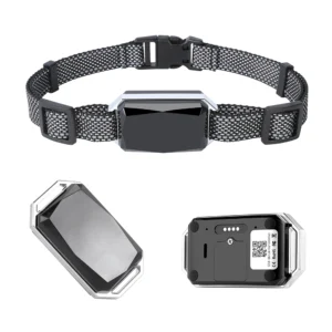
| Pet/elderly/child guardianship | Portable, low power, security alarm | Real-time transport (NB-IoT) | Accuracy 5-10m, endurance ≥14 days, small size (collar/bracelet) |
| Outdoor Expedition (mountaineering/sailing) | No signal available, off-line recording | Satellite + offline | Satellite coverage, storage ≥4 GB, waterproof IP68 |
| Exercise record (running/cycling) | Offline trajectories, data analysis | Offline recording | Multi-star positioning, support for heart rate synchronization, battery life ≥24 hours |
| Logistics container tracking | Low power consumption and low cost | Real-time transport (NB-IoT) | Transmission 5-10 min/shot, battery life ≥6 months, temperature and humidity sensor support |
Not only will you be able to understand how the GPS tracker works, but you’ll also be able to choose the right device for your needs-after all, knowing how it works will help you solve problems better.

