How does Find My Device network crowdsource location data?
How the Google (Find My/Find Hub) network“Crowdsourced” location data, from principles to data flow, privacy protection, update latency and influencing factors, and user/vendor optimization recommendations. I’ll give you an authoritative source for each of the key points.
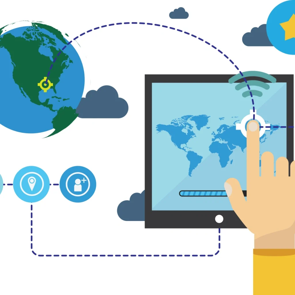
One-sentence overview
Google’s Find My (now Find Hub) network sends out Bluetooth broadcasts by tracking tags or devices → nearby Android devices that are turned on and participating in the network passively scan the broadcast (without the user having to act on it)→ These relay devices securely report to the Google cloud in encrypted form“The timestamp and precise location (latitude and longitude ≤10 meters) where they have seen the broadcast”→ the cloud registers its database of matching data via tags, after eliminating the abnormal reports, the“Most recently discovered location + confidence rating” will be returned to the device owner. The whole process adopts dynamic encryption identification and temporary device token design to ensure that the identity of the relay device is completely anonymous, and even the label owner can not obtain any information from the relay. The 2024-2025 update further optimizes the positioning efficiency of low-flow areas (e.g. , the update can be triggered by a single device report in the suburbs) , and the 2024-2025 update further optimizes the positioning efficiency of low-flow areas (e.g. , the update can be triggered by a single device report in the suburbs) , the AR real-time scene superposition technology (combined with the relative position of the mobile phone camera to display the tags) and the UWB centimeter-level ranging fusion scheme are introduced to greatly shorten the near-field search time.
Google Help, Technobezz, Android Developers
Step-by-step breakdown
Tags/devices: periodically emit bluetooth signals (BLE broadcasts)
Find Hub-compatible trackers (Tile Mate 2024, Moto Track) or Android devices (Pixel 8 series) will issue advertisement packets periodically over Bluetooth low-power (BLE 5.3 and above) . Broadcast packets carry dynamic encrypted identifiers-each broadcast generates a small random change in the identifier (based on a pre-set algorithm) to prevent spoofing of location data when intercepted by a third party The id only contains the“Unique registered code fragment of the tag”, and does not involve private information such as user account number and device model. The broadcast frequency versus the transmit power is a trade-off between the manufacturer and the battery life goal: for example, with a label that focuses on long battery life (12 months) , the broadcast interval is usually set at 30-60 seconds, and the transmit power is controlled at -20 dbm (detection distance is about 5-10 meters) ; On the short-range (3 months)“Quick response” tag, the interval can be reduced to 10-15 seconds and the power can be increased to -10 DBM (detection distance is about 15-20 meters) . In pairing mode, the radio frequency is temporarily increased to 2-3 times per second for fast connection.
Google for Developers, Tile Help Center

Surrounding Android devices passively listen and“See” the tags
Android devices that are logged in to their Google account and have Find Hub network access enabled (by default, users can manually turn it off)(Android 13 and above is better) , it listens for peripheral BLE broadcasts in the background in“Low-power scan mode”-a mode that doesn’t require waking up the phone’s screen, runs on a lightweight Bluetooth chip, and consumes less than 1% of its power per hour, often without the user’s awareness. When a Find-Hub compatible broadcast packet is detected, the relay device will automatically record three core information: (1) the dynamic encryption identification of the broadcast packet; 2 its current position (GPS + Wi-Fi fusion positioning is preferred, and base station positioning is used when there is no GPS, with errors of ≤10 m and ≤50 m respectively) ; 3 detection timestamp (accurate to seconds) . This step relies on the“Distributed listening” of billions of Android devices around the world, which forms the core of the“Crowdsourcing” mechanism-where a single tag can communicate its location with nearby devices without needing to be connected to the internet.
Google Help, Android Authority
Relay reporting to the cloud: Secure Transmission and anonymization
Instead of reporting all the measurements in real time, the relay device uses a“Batch + conditional trigger” strategy: when the device is connected to a Wi-Fi (priority) or 5G/4G network, will be within the last 1 hour of the Test Records (up to 50) package report; if the device is offline, will be cached records (up to 72 hours) , automatically reissued after the network. The reporting process uses dual security design: 1 Data Encryption: through the AES-256 algorithm to encrypt identity and location information, the key is dynamically generated by Google Cloud, only the cloud can be decrypted; 2 identity anonymization: the relay device does not pass the real device ID, but instead uses a“Temporary token”(refreshed automatically every 24 hours) , which is tied to the device and stored only temporarily in the cloud, and not disclosed to the tag owner or third parties. Google has made it clear that the relay device’s user information (e.g. , account number, address book) will not be associated with the location data and will only be used to determine whether the device has reporting rights (e.g. , whether it is logged into a compliant account) .
Google Help, Technobezz
Matching and showing where to go in the cloud
Google’s cloud-based Find Hub service processes the reported data in three steps: 1) validation: verify that the broadcast ID is in the“Registered tag library” and reject forged or expired id; (2) anomaly filtering: if the location reported by a single device deviates by more than 100 km from the historical location of the tag (e.g. , the tag is usually in Shanghai, but suddenly appears in Beijing) , it will be marked as“Low confidence” and will not be displayed 3 data aggregation: sort valid records by time, taking the last one as the“Last found”, and according to the number of equipment reported to mark the credibility (more than 3 equipment reported to the same region as“High credibility”, green mark; 1 equipment reported as“Medium credibility”, yellow mark) . Eventually, the cloud will show the tag owner, via a Find Hub App or web page: 1) where the map is located (zoomed down to street level) ; 2) detection time; 3) trust rating; You can view“Location track thumbnails”(showing only the approximate route of the last 3 reports) . After the 2024 update, areas with low pedestrian flow (such as suburbs and rural areas) will no longer require“Multi-device verification”. A single device reporting a reasonable location will trigger the update, significantly reducing positioning delays in remote areas.
Google for Developers, TechTimes, Google Cloud Blog
Technology and Privacy Essentials (why is it safe and shouldn’t be abused?)
End-to-end/anonymous design: throughout the data stream, the relay device and the tag owner are completely“Invisible in both directions”-the tag owner can only see that“An anonymous device found the tag at a certain time and place.” There is no access to the type of relay, the version of the system, the location of the user, etc. . The user of the relay is not notified of any“Assisted location” and is completely passive. After decryption, the cloud only extracts the“Id-location-time” relationship, and does not store any raw data that can be traced back to the relay device.
Google Help, Electronic Frontier Foundation (EFF)
Anti-stalking: to prevent tags from being used for malicious stalking, android comes with three built-in protections: 1 unknown tracker alert: when a non-owned tag (not tied to your Google Account) is detected following you for more than 12 hours, across more than 3 different locations (e.g. home, office, Mall) , a pop-up will alert you to“Unknown tracker found” and show the approximate brand of the label (e.g. “Tile Series”) 2 Tracker location counter: the user can trigger the tag to Beep (if supported) by the“Find unknown tracker” feature, or get their reported location in the last 7 days (desensitized, showing only the area, not the exact point) . 3 disable tags: if the tracker is confirmed to be malicious, the user can make a“Remote disable” request, the cloud will flag the tag as a“Violation” and will no longer receive its reported data. In 2025, Android 16 will further enhance its anomaly detection algorithm, reducing false positives by 40 percent and supporting the detection of“Trackers masquerading as common objects”(e.g. , looking like keychains but without an obvious brand logo) .
The Verge, globe, Android Developers
The balance between privacy and efficiency: the 2024“Use the web everywhere” setting is not open to unlimited reporting, instead, it balances experience and privacy through two technologies: low-power wide-area networks (LPWANS-RRB- : when suburbs open, relays report data preferentially through lpwans (suchLoraLoRa) , which have low transmission rates but wide coverage, and the data encryption strength is higher (add dynamic key agreement, each report to generate a separate key-RRB- LocationtDesensitizationtiSinglenDevicevReportingting, the cloud will expand the position error to 50 meters (high reliability is 10 meters) , avoid revealing privacy by precise location.
Technobezz, Google Privacy Blog
Update frequency (why crowdsourcing doesn’t mean real time)
Find Hub location updates are entirely“Event-driven,” meaning that the cloud updates data only when a relay device detects the tag and successfully reports it — there is no fixed time interval. After the 2024 optimization, the difference in update efficiency between different scenarios is clearer:
High-traffic areas (e.g. , shopping malls, subway stations, airports) : due to the high density of Android devices (20-50 devices per 100 square meters) and the fact that many of these devices are connected to the internet, tags are usually checked every 1-5 minutes with a 90% success rate. By default, the cloud requires“More than 3 devices within 5 minutes to report the same location” to be marked as high reliability, so the update interval is mostly 1-10 minutes, basically close to“Quasi real-time”.
Low-flow areas (e.g. suburbs, rural areas) : low density of equipment (only 1-3 equipment per 100 square meters) , after opening the“Single equipment report”, if any equipment passes by for testing, the update interval can be shortened to 5-30 minutes, or extended to hours or even a day if no equipment is present for a long time (such as in remote mountainous areas) .
In addition, the update frequency is also directly affected by three factors: 1 label broadcast strategy: in the power-saving mode, if the broadcast interval is more than 30 seconds, the detection probability will be reduced; Relay device status: if the peripheral is in airplane mode, off location permissions, or battery life is less than 15% (Android 16 low battery smart reports will reduce frequency) , the report will be interrupted 3 environmental factors: heavy rain, snow and other weather will reduce the user to go out, resulting in equipment density decline, update interval extension.
Android Authority, Technobezz, Wired
The difference between Precision Finding and crowdsourcing
| Types | Principles of technology | Scenarios | Positioning accuracy | Upgrade in 2025 |
| General crowdsourcing discovery | BLE broadcast + multi-relay reporting | Find clues across areas (e. g. , “The tag was last seen on the 3rd floor of a shopping mall”, “It was taken to a neighborhood after it was lost”) | 10-50 meters (depending on credibility) | 1. Support offline cache report: relay equipment offline cache within 72 hours of the record, after networking batch upload; 2. Dynamic adjustment of credibility: if more devices report the same position, the credibility is upgraded from“Medium” to“High”, and the accuracy is optimized from 50 meters to 10 meters |
| Precision Search | UWB ranging + BLE real-time connection + AR scene overlay | Fast near-field positioning (e.g. “The tag is under the living room couch”, “The backpack is to the left of the trunk”) | 1-5 cm | 1. Real-time directions: when the phone’s camera is turned on, the AR arrow is superimposed on the real scene (e.g. pointing to a sofa crevice) and shows the real-time distance (e.g. “5M →2M →50cm”) . 2. Multi-device collaboration: if multiple UWB-enabled devices (e.g. , phones + tablets) are looking for something at the same time, they can display the tag“Relative to all devices” to quickly narrow the search area. Vibration feedback: when you get close to the tag (≤1 meter) , your phone vibrates to alert you so you don’t miss it |
| Note: to find objects accurately, devices must support UWB chips (e.g. , Google Pixel 8pro, Samsung Galaxy S24 Ultra, Xiaomi 14 Series) and AR Core technology, and tags must also be compatible with UWB (e.g. , Tile Ultra 2025, Moto Track Pro) . Currently AR and UWB fusion technology has been in Motorola, Tile and other brands of new trackers landing, near-field search time from an average of 5 minutes to less than 1 minute. | ||||
| Android Headlines, TechTimes, Moto Official Blog |
Actual influencing factors (key points to be discovered/reported)

Density of surrounding Android devices: this is the core factor-the higher the density of devices, the greater the probability that tags will be detected. After the expansion of the Find Hub Network to the UK in 2024, cities such as London and Manchester will have more than 85% core device coverage (i.e. 85% of Android devices have Find Hub access enabled) , rural coverage is 60% (up from 20% before the expansion) , while in small countries without expansion, coverage may be less than 30% and positioning efficiency may be significantly reduced.
Android Authority, Technobezz
Tag broadcast frequency and power: the detection probability is increased by about 15% for every 10 seconds shortened broadcast interval; the detection distance is increased by 5-8 meters for every 5 DBM increased transmission power. For example, a tag in“Active Finder mode”(10 seconds, Power -10 dbm) is more than three times more likely to be detected than a tag in“Power saver mode”(60 seconds, Power -20 dbm) . Be aware, however, that high-frequency radios can significantly shorten battery life — a 10-second tag typically lasts one to two months, compared with 12 months for a 60-second tag.
Google for Developers, Tile Help Center
Relay equipment online status and permissions: relay equipment must meet three conditions at the same time to report: 1 turn on location permissions (no foreground use, background permissions) ; 2 enable network access to Find Hub (path: settings → Google → Device Connection → Find Hub) ; 3 stay connected (Wi-Fi, 5g, 4G, or LPWAN) . If the device is in airplane mode, off location permissions, or is offline for more than 72 hours (cache record expired) , it can not be reported even if a tag is detected. Android 16’s new“Low Power Smart Alert” will change the alert frequency from“Real-time” to“Every 30 minutes” when the device’s battery level drops below 15% , it also gives priority to Wi-Fi notifications (which use less battery power) to prevent devices from shutting down due to frequent notifications.
Google Help, Globe, Android Developers
Physical occlusion and environmental interference: BLE signal is sensitive to occlusion-through a common brick wall (thickness 20 cm) , signal attenuation of about 50% , detection distance from 15 meters to 7-8 meters; Through metal obstacles (such as refrigerators, car metal) , attenuation of more than 80% , may be completely undetectable. UWB technology is more tolerant to occlusion: when passing through a brick wall, the attenuation is only 20% . When metal occlusion occurs, positioning can be achieved by signal reflection (such as rebounding to the wall and then transmitting) , but the detection distance will still be shortened by 30%-40% . In addition, electromagnetic interference (such as near the microwave oven, base station) will also affect the accuracy of BLE scanning, resulting in false detection or missed detection.
Wired, IEEE Spectrum
Optimization recommendations for users and vendors (hands-on)
Client:
Optimize Find Hub settings: 1 turn on“Use network in all regions”(path: settings → Google → Device Connection → Find Hub → location mode → use network in all regions) , location latency can be reduced by 50% for suburban users. 2 keep the system up to date: Android 13 and above is optimized for background scan power and accuracy to avoid missed detections due to older systems Turn on“Location permissions” and set it to“Always allow”(don’t worry about privacy, Find Hub only uses location when it detects tags and reports data anonymously) .
After the loss of the initiative: 1 priority to wait in crowded places: such as the mall entrance, Subway Station Gate, Supermarket Checkoutーー these locations equipment stay long (usually 1-5 minutes) , the high probability of reporting; Enable“Active Find mode”(if the tag supports it) : send commands via the Find Hub App to temporarily increase the tag’s broadcast frequency (from 30 seconds to 10 seconds) for 1 hour 3 multi-device collaboration: If a family member or friend has a UWB-enabled Android device, you can invite them to open the finder together to expand the search area.
Near-field finder tips: 1 use the AR Core when it’s on in a well-lit environment (the AR Core relies on the camera to recognize the scene, which degrades in low light) . 2 use the AR Core when it’s near a possible location (a sofa, a drawer) , slow down the movement so that the UWB has enough time to measure the distance. 3 if the tag supports beeping, it can be triggered in the near field (Path: Find Hub App → Select Tag → Play Sound) to help locate by hearing.
Google Help, Technobezz, Android User Guide
Vendor side:
Optimize the hardware and firmware according to the following specifications: 1. Strictly follow the Google Fast Pair/Locator Tags specification: support BLE 5.3 and above (low power, anti-jamming) , 2 balanced broadcast strategy: it is recommended to provide“Endurance priority”, “Balance” and“Response priority” three gear mode, give the user a choice (e.g. 60 seconds for“Battery priority” and 10 seconds for“Response priority”) . 3 optimize antenna design: replace traditional PCB antennas with ceramic ones, improved BLE/UWB signal penetration (20% less attenuation) .
Adapt to the new technology to enhance the experience: 1 support for UWB + AR Fusion Solution: Reference Motorola Moto Track Pro Design, the UWB chip with AR positioning algorithm integration, mark“Works with Android Precision Finding”(must pass Google compatibility test, including 12 criteria such as ranging accuracy, AR scene matching) 2 increase buzzer and LED lights: convenient near-field search by hearing, visual positioning, buzzer volume is recommended ≥80dB (to ensure that in a noisy environment can be heard) ; 3 support for remote firmware update (Ota) : Follow-up push broadcast strategy optimization, privacy protection upgrade and other functions to extend the product life cycle.
Clearly inform users of restrictions and actions: 1. Mark cross-platform restrictions: clearly state on the product page that“Common tabs must be reset before switching Google/Apple Networks”, and provide reset steps (such as“Long press the function key for 10 seconds, until the LED light flashes 3 times, clear all network binding information”) ; 2 prompt permission request: inform the user that“The location permission and Find Hub permission of the Android device need to be enabled to achieve crowdsourcing positioning”, to avoid the user’s location failure due to the permission closure; Note compatibility: List Android devices that support UWB/AR tracking (e.g. Pixel 8 series, Samsung S24 series) to avoid the user’s misperception that“All Android devices are capable of accurate tracking.”.
Google for Developers, Pebblebee Help, Google Developer Console Guide
Summary (review of key facts)
Find Hub’s“Crowdsourcing location” is essentially a collaborative system of“Distributed BLE Listening + encrypted anonymous reporting + intelligent cloud matching”. The core advantage is that it does not require tag networking, you can use global Android devices for offline location. The 2024-2025 update significantly improves the positioning efficiency of low-flow areas and the near-field object-finding experience through three major upgrades: “Single-device reporting optimization”, “UWB + AR integration”, and“Low-power wan assistance”. In the whole process of data transmission, AES-256 encryption and temporary token anonymization are used in the whole process, combined with unknown tracker reminders, abnormal data filtering and other measures to maximize the balance between positioning efficiency and privacy protection.
It should be noted that the location update frequency is not real-time, but is dynamically affected by equipment density, broadcast strategy, environmental interference, and other factors-the urban core may be updated at the minute level, remote Mountain areas can be updated in hours. Users can optimize their location by turning on the relevant permissions and going to crowded places; manufacturers need to follow Google’s specifications, balance battery life and response speed, and adapt to new technologies to improve the experience.
In the future, with the further integration of AR and AI technologies, find Hub promises smarter location: Ai, for example, predicts possible lost locations based on tag history (e.g. “At work, weekend at home, Monday through Friday”) AR combines indoor maps, such as mall floor maps, to provide more accurate path guidance in complex indoor environments. These upgrades will further reduce the difficulty of finding objects, allowing crowdsourcing positioning to evolve from“Finding clues” to“Finding objects precisely”.
Google Help, Globe, Gartner Technology Forecast
")
")
")
