GPS Tracker accuracy: from principle to real-world scenarios
positioning accuracy (principle and data) in an ideal environment
At the heart of the ideal scenario is an unobstructed, stable transmission of satellite signals-usually in an outdoor area of open plains, unobstructed by tall buildings or trees, where GPS signals can reach the device directly, free from reflection and attenuation, with optimal positioning accuracy. The specific data are as follows:
![]()
Ordinary civilian GPS (single constellation, such as only support the United States GPS-RRB- : positioning accuracy of about 2-5 meters, enough to meet daily needs (such as finding the location of vehicles, confirm the general direction of personnel) .
Multi-constellation high-performance chip (GPS + GLONASS + Galileo + Beidou) : Double the number of visible satellites (usually can receive 8-12 satellites at the same time) , accuracy to 1-3 meters, it is suitable for professional outdoor navigation, precise fleet management and other scenarios with slightly higher accuracy requirements.
Professional RTK equipment (real-time dynamic differential positioning) : real-time communication through“Equipment + ground reference station”, correction of satellite signal error, accuracy can reach, centimeter level (1-5 cm) , it is mainly used for surveying and mapping exploration, unmanned driving, agricultural precision seeding and other professional fields, but it requires additional deployment of reference stations and has high cost.
Three core factors affecting the accuracy of GPS Tracker
The essence of GPS positioning is that the equipment receives multiple satellite signals and determines the position by calculating the time difference of signal propagation. Therefore, any factor that interferes with signal transmission and calculation will directly affect the accuracy.
![]()
Environmental Occlusion: the main source of error
Different scenes have different degrees of occlusion of the signal, and the error range varies significantly. The common scenes are as follows:
| Type of scene | Signal status | Positioning accuracy (margin of error) | Typical case |
| Open Air (plain/Peak) | The signal is transmitted directly, with no obstruction | 2-5m (Best) | Suburban roads, outdoor camping |
| Urban canyons (high-rise areas) | The signal is reflected off the wall (multipath effect) | 10-50 meters | Downtown streets, around office buildings |
| Dense Forest/boulevard | The signal is obscured and attenuated by the leaves | 20-100 meters | Forest Parks, mountain hikes |
| Indoor/underground space | The signal is completely shielded (or extremely weak) | Unable to locate/error > 100 meters | Shopping malls, underground car parks, elevators |
| Bad weather (heavy rain/snow/fog) | Signal attenuation as it passes through obstacles | 5-15m (up from ideal) | Driving in the Tianshan Mountains during heavy rain and snow |
Satellite conditions: number, distribution and signal strength
The core of positioning is“The effective reception of satellite signals”, which is not“The more satellites, the better”, but needs to meet the three conditions of sufficient number, reasonable distribution and stable signal:
Number of satellites: civil positioning needs at least 4 satellites (3 to calculate three-dimensional coordinates: longitude, latitude and altitude; 1 to correct time errors) , and the accuracy will be significantly improved when 6-12 satellites are actually received.
Satellite distribution: satellites need to be scattered in different regions of the sky (the larger the included angle, the better) . If the satellites are concentrated in the same direction (such as near the horizon) , it will lead to the increase of“Geometric dilution accuracy”(GDOP) and the increase of error On the other hand, if the satellites are evenly distributed in the four directions of East, south, west and north, the calculated position will be more accurate.
Signal Strength: signals from satellites close to the horizon (elevation < 10 °) need to penetrate the thicker atmosphere and are severely attenuated and susceptible to interference; signals from satellites with elevations of 30 °-60 ° are the strongest and are the“Main satellites” for positioning.
![]()
Technical Blessing: How to improve accuracy through technology?
In addition to hardware chips, assistive technologies can dramatically improve localization performance in complex scenarios. Common technologies include:
| Types of technologies | How it works | Effect of precision improvement | Scenarios |
| A-GPS | The“Approximate area” is obtained through cellular base stations/WI-FI, and the satellite ephemeris (satellite location data) is quickly downloaded to shorten the satellite search time | The accuracy is the same as ordinary GPS (2-5 meters) , but the search time is shortened from 1-3 minutes to 10-30 seconds | An area with a weak signal but a network (as a suburb or village in a city) |
| Multi-constellation fusion (GPS + Beidou, etc.) | Receiving signals from multiple satellite systems at the same time, increasing the number of visible satellites and reducing the probability of“No satellite available” | Accuracy to 1-3 meters, complex environment (such as urban canyons) under the positioning success rate increased by more than 50% | Car Navigation, outdoor trackers |
| Sbas (satellite augmentation system) | Using synchronous satellite (such as China BDS enhancement, the United States WAAS) broadcast correction information, no ground base station | The accuracy is improved to 1-3 meters to avoid the blind area covered by the ground base station | Civil Aviation, outdoor hiking, navigation |
| Differential GPS -DGPSDGPS) | The ground reference station calculates satellite signal errors and sends them in real time to the equipment for correction (RTK is one of the high-precision types) | Ordinary DGPS: sub-meter scale (0.5-1 m) ; RTK: centimeter scale (1-5 cm) | Ordinary DGPS: shipping, agriculture; RTK: mapping, unmanned |
| Multi-sensor fusion (GPS + IMU) | The IMU (inertial measurement unit) records velocity and acceleration and temporarily compensates for the loss of a GPS signal, such as through a tunnel | In short time (10-30 seconds) the error is less than 5 meters, to avoid positioning interruption | Vehicle Navigation, drones |
Accuracy comparison of equipment in different scenarios
![]()
The accuracy of a GPS Tracker depends not only on the technology, but also on the shape of the device and the use scenario (such as antenna size, installation location, power supply stability) . The accuracy of common devices is as follows:
| Type of equipment | Core constraints | Positioning accuracy (typical range) | Scenarios |
| Built-in GPS | The antenna is small (covered by the fuselage) and easily affected by the hand-held posture | 3-10 meters | Mobile navigation, shared location |
| In-car GPS Tracker | Fixed antenna position (roof/dashboard) , multi-constellation support | 2-5 meters | Vehicle location, anti-theft tracking |
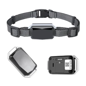
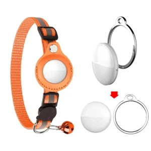
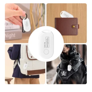
| Portable Tracker for pets/people | Small size (more compact antenna) and easily obscured by clothing/hair | 5-15 meters | Anti-lost pets, elderly/child guardianship |
| Sports watches GPS | Antennas are miniaturized and interfered with by states of motion, such as running arms | 5-15 meters | Outdoor running and cycling trails |
| Professional Outdoor GPS (e. g. Garmin) | Antenna Optimization, SBAS support | 1-3 meters | Climbing, hiking, exploring |
| Mapping/agriculture RTK equipment | Coordination of ground base station/mobile station | 1-5 cm | Land mapping, farmland sowing, building construction |
Practical summary and purchase suggestions core conclusion
For daily use (vehicle, PET/person tracking) : General GPS Tracker accuracy is sufficient to meet requirements, 2-5 meters for accurate positioning, 10-50 meters error (urban canyon) does not affect the“Find the general area”.
Complex scenarios to deal with: if you often live in high-rise buildings, forests, preferred to support multi-constellation + SBAS equipment; if you need indoor positioning, Wi-Fi/Bluetooth/UWB (UWB accuracy within 10 cm, but requires equipment support) .
Professional Requirements: mapping, unmanned RTK equipment; agriculture, shipping to ordinary DGPS, to avoid excessive pursuit of high precision resulting in cost waste.
FAQ
Q: Why does my Tracker occasionally“Drift”?
A: it is usually caused by temporary interference, such as instantaneous signal interruption (blocked by tall buildings) and multipath effect (the signal is misjudged after being reflected by the wall) . It usually returns to normal after 1-2 minutes, which is a normal phenomenon for civilian GPS users.
Q: is a multi-constellation system better than a single GPS?
A: Yes, especially in urban canyons, forests and other scenarios, multi-constellation can receive 3-5 more satellites, positioning success rate increased by more than 50% , more stable accuracy.
Q: does indoor location only depend on Wi-Fi/Bluetooth?
A: In addition to Wi-Fi/Bluetooth, you can also use UWB (ultra-wideband, short-range high-precision) and indoor beidou (some pilot areas) , but it requires device hardware support. At present, the common Tracker is still mainly assisted by WI-FI/Bluetooth.
Through the above supplement, the article not only covers the“Precision data”, but also explains the“Reasons for the difference in precision” and“Practical use suggestions”, helping users to understand“Why different scenarios have different precisions”, and can choose the appropriate GPS Tracker according to their needs.

