Introduction
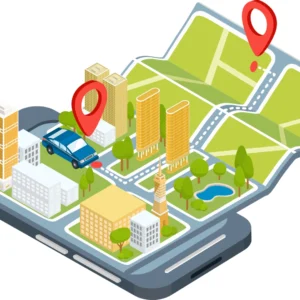
In today’s hyper-connected world, location technology has become the“Invisible infrastructure” of personal and business life. GPS -Global Positioning System-RRB-tem) trackers rely on a network of 24 earth-orbiting satellites to calculate three-dimensional coordinates (longitude, latitude and altitude) by receiving signals from at least four satellites, positioning accuracy in the open area can reach 1-3 meters, urban areas due to building blocks will be reduced to 5-10 meters. In addition to real-time location updates and historical trajectory storage, modern GPS devices can integrate sensors (temperature, vibration, heart rate) and multiple communication modules (4G, Bluetooth, satellite communications) , from a single location tool to an integrated solution of“Location + data services”. From personal security guards to corporate supply chain management, GPS trackers are reconfiguring the boundary between efficiency and security. This paper will comprehensively analyze its core uses in different fields based on actual scenarios, technical parameters and industry cases.
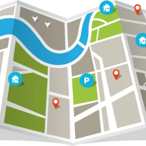
![]()
Personal use: from security to convenience
1. Safety for children and the elderly
Parents often choose smart watches with integrated GPS functions for children aged 4 to 12. In addition to real-time positioning, such devices also have“Triple protection” functions: first, electronic fences, it can set a safe area of 50-200 meters around the school and home, and the parents’ mobile phone will immediately pop-up alarm when the child is out of the range. The second is fall detection, through the built-in accelerometer sensor, the elderly fall within 10 seconds after the automatic trigger SOS call (priority contact children) ; three is one-way listening, parents can listen to the sound around the device, to confirm whether the child is in a safe environment. For example, Garmin’s GPS bracelet for Alzheimer’s patients is made of medical-grade silicone that lasts up to 15 days and is IP68 waterproof (it can be immersed in 1.5 m of water for 30 minutes) , in one nursing home in the United States, the number of missing people dropped from three a month to zero. Some schools in Europe and the United States will also be equipped with GPS badges for students to facilitate teachers in spring outings, sports meetings and other collective activities to quickly count the number of people.
2. Pet tracking
There are two main types of GPS collars: “Small dog/cat” and“Large dog”. The small model weighs only 15 grams (to avoid placing a burden on the pet’s neck) , the larger models are made of Kevlar and have a 7-to 14-day battery life. High-end collars from global brands such as Tile support“Remote listening plus activity statistics”-an APP that lets users hear if a pet is stuck in a hallway or in the grass (such as a puppy’s whimper) , daily activity reports can also be generated (e. g. 1.5 hours of daily activity for medium-sized dogs, with push notifications when below standard) . Some collars also feature a“Virtual leash” for outdoor dog-walking situations: the collars emit light vibrations and light and sound alerts when the pet is 10 to 15 meters beyond the owner’s range, avoid getting lost chasing stray animals. Data from a pet rescue station in the U. S. shows that 85% of pets wearing GPS collars are found after being lost, and the average recovery time is shortened to 1 hour.
![]()
3. Protect your valuables
Miniaturization and multi-scenario adaptation are core trends in personal-goods GPS trackers: push-button devices (1.5 cm in diameter and 3G in weight) can be slipped into wallets, passport holders, and other gadgets, card-like devices (0.3 cm thick) can be affixed to the surface of laptops, guitars and other items, the bike-specific design is“Hidden under the seat”(to avoid being found and removed by thieves) . Many of these devices use“Bluetooth + GPS dual-mode positioning”: Bluetooth triggers a bell for short distances (up to 10 metres)(such as looking for a suitcase near an airport luggage carousel) , and GPS syncs the location to the cloud for longer distances. Some devices also support“Off-line location”-16 MB of built-in storage that stores up to seven days’ worth of location data when disconnected, and automatically uploads it when connected to the internet, when a box is opened without permission, the user is immediately alerted, and one cross-border traveler successfully recovered a camera that had been illegally taken by a customs officer.
4. Personal Safety and special guardianship
The outdoor-specific GPS tracker is optimized for extreme conditions: the mountaineering model has an altitude warning function (it can be programmed to warn of altitude above 3,000 meters to prevent altitude sickness) , it also supports offline map downloads (such as the contour map of the Himalayas) , and vibrates and issues a voice alarm if you deviate from the preset route (to avoid missing notifications due to silence) . For women living alone and night shift workers (such as nurses and food delivery workers) , some of the devices are designed with a“Disguised call” function-a preset call can be triggered by pressing the device button for a long time, it also automatically sends real-time locations to emergency contacts. In the North n winter, when it is -20 °C, outdoor brands such as sunto’s GPS devices can operate normally (down to 70% of normal in cold temperatures) , ensuring the location needs of skiers.
5. Medical monitoring of special groups
Medical-grade GPS trackers provide“Health data + location” dual monitoring for patients with chronic diseases: devices for diabetics can monitor blood glucose in real time through non-invasive glucose sensors (patch-type) , blood glucose levels and location information will be sent immediately to family members and community hospitals if they exceed 4.4-7.0 mmol/l (the normal fasting range) or 10.0 mmol/L (the normal range 2 hours after eating) The heart patient device incorporates an electrocardiogram sensor that automatically triggers an emergency call when the heart rate spikes (e.g. , more than 120 beats per minute) or an arrhythmia occurs. In the internal management of the hospital, wheelchairs, ambulances, mobile monitors and other equipment will be fitted with micro-GPS (the size of a fingernail) . After the application of a third-class hospital, the time to find equipment has been shortened from an average of 15 minutes to 30 seconds, the efficiency of equipment deployment in emergency treatment has been improved by 50% .
Vehicle and asset tracking: from security to life-cycle management
1. anti-theft vehicle tracking
Car GPS tracker is divided into“Wired” and“Wireless”: Wired model requires access to the vehicle OBD interface (or power line) , long-lasting, suitable for private cars, trucks (can monitor the engine status simultaneously) ; The wireless model is magnetically attached to the undercarriage, fuel tank, etc. . The battery lasts for 3-6 months and is suitable for motorcycles and electric vehicles (to avoid damage by thieves) . Once the vehicle is stolen, users can use the APP to perform“Remote control in three steps”: first, lock the vehicle (prohibiting the vehicle from starting) ; second, cut off the fuel/circuit (forcing the vehicle to shut down) ; The third step is to sync your location with the police in real time (10 seconds per update) . According to 2024 data from the U.S. Department of Justice, the recovery rate for GPS-tagged vehicles was 92 percent, and the average recovery time was reduced from 24 hours to two hours. U. S. Police in a region through GPS tracking, inter-provincial theft gangs transfer vehicles, in the highway service area precision interception, a one-time recovery of 12 stolen cars.
2. Fleet management: Cost Reduction and safety improvement
Logistics companies use GPS systems to achieve“Triple optimization”: first, route optimization, combined with real-time traffic data such as Google Maps (Google Maps) to avoid congestion. After an American Express delivery company applied it to 500 trucks across the country, one-way transportation time is reduced by 15% and fuel costs are reduced by 8% (about $1,200 per vehicle per month) , the system can monitor behaviors such as rapid acceleration (acceleration > 0.8 g) , sudden braking (deceleration <-0.6 g) , and speeding (exceeding the road speed limit by 10%) , and generate a monthly score table for drivers. After targeted training, the accident rate of the fleet has been reduced by 30% . Third, maintenance early warning, according to the mileage of the vehicle (such as changing the oil every 5,000 kilometers) and the running time of the engine, automatically push the maintenance reminder. After a freight company applied it, the number of days of downtime due to mechanical failure was reduced from five to one per month. Some cold chain teams will also integrate temperature sensors in the GPS system to monitor the freezing environment of -18 °C in the carriage in real time to avoid fresh deterioration.
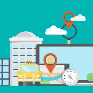
![]()
3. Rental services and shared asset control
Car-sharing companies such as Zipcar and electric scooters such as Lime are using GPS to achieve“Smart dispatch and illegal control”: if an electric scooter user parks his device in a prohibited area (within 30 metres of a subway entrance, for example) , gPS will detect the position and lock the vehicle (can not end the order) , the user will need to move the vehicle to the designated area to settle the account; at night, the system can filter out the power of more than 50% of the scooters, direct staff to focus on transportation to popular areas (e. g. business district, Office Building) to improve the next morning peak utilization rate. In the car-rental business, GPS can not only monitor whether a vehicle is out of range (such as when a user rents a“City car” and travels across provinces) , but can also record real-time miles to the nearest 0.1 km, to avoid people misreporting their journeys (say, 150km for a 200km trip) . After the application of GPS on a car-sharing platform in the United States, the illegal parking rate of vehicles has been reduced from 25% to 8% , and the scheduling efficiency has been improved by 40% .
4. Large-scale equipment monitoring: from anti-theft to precise operation
In construction, gPS trackers for excavators, cranes and other equipment can record“Working hours + working position + working condition data”: Enterprises can count equipment utilization by working hours (for example, excavators on a site work an average of six hours a day, and the utilization rate reaches 75%) , to avoid idle equipment, work location data can verify whether the equipment is in the contracted construction area (to prevent misappropriation to other sites) ; Working condition data (such as engine speed, hydraulic system pressure) can also be early warning of mechanical failure (such as abnormal pressure prompt hydraulic pump maintenance) . In agriculture, the GPS of tractors and harvesters can be linked to farm management software from brands such as John Deere to achieve“Precision seeding”-by locating the area in which they work, calculate the amount of seed needed per acre (15 kilograms per acre of wheat, for example) to avoid waste; a family farm in Europe reduced fertilizer use by 20 percent and increased crop yields by 12 percent, the rate of equipment theft has fallen from two to zero a year.
Business and logistics applications: Full-chain visualization of supply chains
1. Supply chain visualization: from“Black box” to“Transparency”
GPS trackers provide“Multi-dimensional monitoring” for the transport of high-value, high-sensitivity goods: when transporting vaccines in cold-chain logistics, the device needs to transmit 2-8 °C of temperature data every minute, if the temperature is out of range (for example, the temperature of the carriage rises to 10 °C in summer) , the system will send text message + APP + phone triple alarm to the manager, and automatically record the abnormal time period (as the basis for subsequent responsibility identification) ; After a biopharmaceutical company in the United States applied the system, the loss rate of vaccine transportation decreased from 3% to 0.5% . When shipping fresh (e.g. , imported fruit) , purchasers (e.g. , supermarkets) can view the location (updated every 5 minutes) , temperature, and estimated time of arrival in real time via a QR code link provided by the merchant, arrange Cold Storage and unloading personnel in advance. Some high-end equipment also has vibration sensors (sensitivity adjustable) , when transporting fragile items (such as ceramics, glass) , if the vibration amplitude exceeds 2G (about equivalent to fall from a height of 1 meter) , will immediately record and alarm, after a European porcelain manufacturer used the sensor, the breakage rate dropped from 8% to 2% .
2. Optimizing distribution services: improving efficiency and customer experience
The delivery (e.g. , Uber Eats) and express (e.g. , FedEx) industries have achieved a dual upgrade of“Intelligent scheduling + real-time interaction” through GPS: the scheduling system of the delivery platform is based on GPS data, an algorithm called“Subarea Delivery + route merging” is used to assign 3-5 orders within 3 km to the same rider, and plan the optimal meal pick-up and delivery routes. After the application of an American head delivery platform, rider orders per delivery increased by 20% , and timeouts dropped from 12% to less than 5% . In the terminal delivery, the Courier’s GPS position is linked with the Locker (e. g. Amazon Locker) . When the courier arrives within 500 meters of the area, the system automatically sends a reminder to the recipient After the application of an express company, the recipient omission rate is reduced from 15% to 6% . For fresh delivery, GPS can also be linked with the temperature control box, users can check the temperature changes of ingredients during the delivery process (such as whether the frozen meat is kept at -18 °C) , to enhance consumer trust.
3. Field personnel management: balance between safety and efficiency
For electric power inspectors, gas maintenance personnel, sales personnel and other field positions, the GPS system mainly realizes“Work trajectory tracking + security”: electric power inspectors need to cover all substations in their jurisdiction as planned, gPS can record whether it reaches the designated inspection point (positioning error ≤10 meters) , and upload inspection photos (photos with GPS watermarks to avoid false clocking) , the inspection coverage rate was increased from 90% to 100% , and the failure rate caused by missed detection was reduced by 35% . The GPS of the sales staff is used to count the“Effective visiting time”(≥30 minutes in the customer’s company is considered effective) , to avoid the situation of“Clocking Out”, but companies need to adhere to strict privacy rules — they only record location data during business hours (e.g. , 9:00-18:00) and automatically stop locating after hours. At the same time, the SOS function of field personnel equipment can ensure the safety of operations in remote areas. For example, when gas maintenance personnel encounter loss or injury in the suburbs, one-click sends location and distress information. After the application of a certain American gas company, the emergency response time of field personnel is shortened to 15 minutes.
Sport and Recreation: from recording to scientific guidance
1. Fitness and exercise records: data-driven improvements in performance
GPS sports equipment (watches, bracelets) commonly used by runners and cyclists can record“Multi-dimensional motion data”: The device can display real-time pace (e.g. 5 minutes and 30 seconds per kilometer) , stride frequency (180 paces per minute) , elevation (e.g. climbing to 500 meters) , and generate trajectory maps (which can be shared on social platforms) It can also calculate the power efficiency of each lap by connecting a pedaling sensor. Apple Watch, Fitbit and other brands of GPS watches support“Heart rate interval monitoring”, the heart rate is divided into“Warm-up zone (50%-60% of the maximum heart rate) , aerobic zone (60%-70%) , anaerobic zone (70%-80%)”, users are reminded to avoid excessive exercise (such as when their heart rate is in the anaerobic zone, which can lead to fatigue) . The special GPS device for swimming is waterproof up to 50 meters, which can record the number of lanes, stroke frequency and turn time to help swimmers optimize their posture. After the application of a professional swimming team in the United States, the team’s 100-meter freestyle performance improved by an average of 2 seconds.
2. Outdoor Adventure: you can travel without a signal
Dedicated GPS trackers for climbing, hiking, sailing, etc. . The core advantage is“Offline + SATCOM”: in areas where climbers don’t have a cell phone signal (e.g. , the Rocky Mountains) , to avoid getting lost, you can view your location through a pre-downloaded offline contour map. The device also supports“Trajectory backtracking”, which allows you to return to the starting point along a historical trajectory if you deviate from a pre-set route. Navigation-specific GPS integrated compass and tidal data, real-time display course (such as 30 ° east-northeast) and high tide time to help the captain plan the route. Some high-end devices, such as GARMIN INREACH, support satellite communications, such as iridium, and can send text messages (for about $1 each) even in areas without terrestrial networks, such as the Pacific and Antarctica, tell your family or rescue team you’re safe. In 2023, an American mountaineering team was rescued from a snowstorm in the Himalayas by sending latitude and longitude coordinates via GPS devices within four hours.
Law Enforcement and security: Precision Control under legal compliance
(1) case investigation and evidence fixation
The use of GPS trackers by law enforcement agencies is governed by the Electronic Communications Privacy Act (ECPA) and requires a court-issued“Technical investigation authorization”. Common scenarios include tracking a gang’s transport vehicle and recording its complete path from the scene of the crime to the point of sale (as evidence in court) , monitoring the movements of suspected drug dealers, and monitoring the movement of suspects, using 72 consecutive hours of location data, they can determine where they meet and who they’re with. GPS tracking is more stealthy than traditional human tracking (the device can be disguised as an in-car charger or a rearview mirror pendant) and can record 24 hours a day, an interprovincial drug smuggling case was successfully solved with the seizure of 5 kg of methamphetamine and the arrest of 8 suspects. As electronic evidence, GPS data need to undergo“Authenticity verification”(such as confirming that the device has not been tampered with and the location data has not been forged) before it can be admitted by the court.
2. Parole and community correction supervision
For parolees, Probationers (e.g. , traffic offenders, Burglars) , the Department of Justice requires them to wear GPS ankle bracelets, the device has two functions of“Geographical restriction + anti-disassembly”: one is to set“No entry area”(such as thieves are prohibited from approaching shopping malls and supermarkets, domestic abusers are prohibited from approaching victims’ homes) , when the personnel out of range, the anklet immediately to the community correction institutions alarm; second, anti-disassembly design, the anklet through the medical grade lock fixed, when the removal will issue a 120 db harsh alarm (equivalent to saw noise) , at the same time trigger position upload. The rate of recidivism among those wearing GPS anklets has fallen from 15% to 3% , according to one state’s community-corrections agency, and regulation has improved by 60% . The anklet lasts up to 30 days and must be recharged under the supervision of a supervisor to avoid escape.
3. Border and Customs Control: risk prevention through land-air linkage
At land borders, such as the one between the United States and Mexico, customs agencies use a three-dimensional network of“Ground GPS + drone GPS”: ground equipment mounted on border patrol vehicles, boundary-marker sensors, and the like, real-time monitoring of suspicious cross-border vehicles (such as unlicensed trucks) trajectory; drones (such as DJI Matrice series) equipped with GPS and thermal imaging cameras, can be at night, fog and other bad weather patrol, locating illegal border crossings (thermal imaging identifies body temperature) . At the maritime border, the GPS of customs patrol boats is linked to a radar system that tracks the movements of suspicious vessels (e.g. those that deviate from international shipping lanes and turn off AIS signals) and issues warnings over VHF radio. In 2024,32 cases involving US $20 million in electronic products and endangered animal products were detected at a US border crossing controlled by GPS. In addition, the customs will install GPS on the containers of imported goods to monitor their transport from the port to the destination, to prevent the diversion of goods.
Conclusion
From the“Micro Guardian” of personal life (child safety, pet anti-lost) , to the“Medium optimization” of business operations (fleet management, supply chain visualization) , to the“Macro-control” of social governance (law enforcement investigation, Border Security) , GPS tracker has deeply penetrated into all aspects of life and work. It not only reduces risk and improves efficiency through location-based functions, but also enables“Data-driven decision-making” through the integration of sensors and communications technologies-such as farms using GPS data to optimize fertilizer rates, logistics companies use GPS data to optimize routes, and community correction agencies use GPS data to reduce recidivism.
With the integration of 5G and AI with Beidou (China’s autonomous satellite navigation system) and GLONASS (Russia’s system) , GPS trackers will be upgraded in three directions: first, “Multi-system compatibility”; Support GPS + beidou + GLONASS multi-mode positioning, improve positioning stability in complex environments (such as urban canyons, tunnels) ; second, “Intelligent prediction”, combined with AI algorithm to analyze historical data, for example, using vehicle GPS and engine data to predict malfunctions (seven days’ warning) , and using PET activity data to predict health risks (such as arthritis symptoms) ; and“Enhanced privacy”, end-side encryption (such as AES-256 algorithm) is used to store location data. Users can set the data retention period (such as 7 days automatic deletion) , and enterprises need to obtain user authorization to use the data. It is foreseeable that GPS trackers will become the“Infrastructure components” of the digital age, releasing value in more niche scenarios such as the industrial Internet of things and smart healthcare.

")
")
")
