Introduction
With the increasing demand of global positioning, GPS tracker has penetrated into many core areas such as personal security, commercial logistics, pet management and so on. According to the Global Positioning Technology report released by Statista in 2024, the Global GPS tracker market was worth $8.76 billion in 2024, with North accounting for 42% of the market (approximately $3.68 billion) , europe accounted for 28% ($2.45 billion) , and the asia-pacific region accounted for 25% ($2.19 billion) . By 2028, the market is expected to exceed $15.23 billion, with a compound annual growth rate of 15.2% .
Behind the boom, however, lies a common sore point: about 60 per cent of GPS tracker users worldwide have experienced“Indoor location failure”. For example, logistics company managers in New York can’t locate goods in underground Manhattan warehouses, parents in Los Angeles can’t find a child wearing a GPS watch in a shopping mall, and pet owners in London lose a GPS-tagged cat in an apartment building-all these scenes point to the same question: Do GPS trackers really work indoors?
This article will start from the nature of technology, combined with the actual cases in North , Europe and the asia-pacific region, analyze the constraints of GPS indoor work, and sort out the current mainstream indoor positioning alternatives, this paper discusses the future direction of multi-technology integration, and provides selection suggestions for users in different scenarios to help global readers fully understand the indoor performance of GPS trackers.
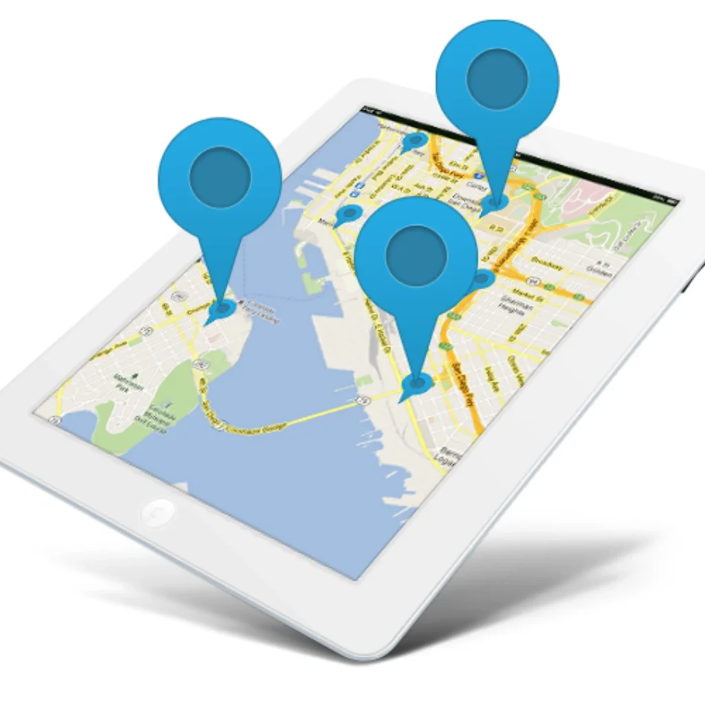
![]()
The basic workings of GPS: why is the outdoors a“Comfort zone”?
To understand the limitations of GPS Indoors, you first need to understand its core technical logic. The Global Positioning System (GPS) , led by the U.S. Department of Defense, currently has 31 satellites in orbit (far more than the basic requirement of 24) spread out over six low-earth orbit planes (four to five in each orbit) , at an altitude of about 20,200 km, it covers every corner of the globe.
1.1“Three core conditions” for positioning
There are three key conditions that a GPS device must satisfy to achieve its position:
Satellite Reception: requires signals from at least four satellites-three to calculate three-dimensional coordinates (longitude, latitude, elevation) , and a fourth to calibrate time errors (synchronization of satellite clocks with equipment) . If only three satellites are received, only two-dimensional positioning can be achieved (altitude can not be determined) , and the error will expand to more than 20 meters.
Signal strength threshold: when a GPS signal is transmitted from a satellite to the ground, its strength drops to between -120 DBM and -150 DBM (DBM is a unit of signal strength, and the closer it gets to 0, the stronger it is) . Signal strength in open areas, such as highways and parks, is usually between -125 DBM and -135 dbm, which is sufficient for positioning; if the signal is weaker than -150 dbm, the device will not be able to parse the data.
No multipath interference: satellite signals need to be transmitted in straight lines. If they encounter obstacles such as buildings, trees and clouds, they will be reflected or refracted (i.e. “Multipath effect”) , this can cause the device to receive multiple“False signals” that interfere with positioning calculations.
1.2 GPS performance of common scenes abroad
In typical outdoor scenarios in North and Europe, GPS can be used with an accuracy of 1-10 meters. For example:
GPS trackers (e.g. Geotab GO9) installed on lorries on California’s highways can be located in real time to within 3 meters, meeting federal DOT freight regulation requirements
A Whistle GO Explore tracker worn by pets in a London Park can accurately track their movements with an accuracy of about 5 meters.
But these advantages quickly disappear when the scene moves indoors — not because of a technical flaw, but because GPS was designed for the“Open environment.”. Data from CTIA’s 2024 tests showed a significant attenuation of the GPS signal as it passed through the building material:
| Building materials | Amplitude of signal attenuation (L1, GPS) | Signal strength in a room | Location effects |
| Wooden Walls (common in U.S. suburbs) | 5-10dB | – 130DBM to-140dBm | Some of the equipment can be positioned with an error of 10-20 meters |
| Normal brick wall | 20-25dB | – 145DBM to-150dBm | Unstable positioning, frequent disconnections |
| Reinforced concrete wall | 35-40dB | – 160DBM to-170dBm | I Can’t locate it at all |
| Glass Wall | 15-20dB | – 140DBM to-145dBm | Multipath interference is severe with an error range of 30-50 meters |
The“Three dilemmas” of GPS trackers indoors
Based on the above principles, the indoor performance of GPS tracker can be summarized as“Attenuation, misalignment and failure”, and the problems show different characteristics in different countries’ building structures.
2.1 signal attenuation: from“Clear” to“Weak”
GPS signals are essentially high-frequency electromagnetic waves (1575.42 mhz in the L-1 band) that can not penetrate high-density materials. In North , where urban high-rises are framed in reinforced concrete (such as office towers in Manhattan) and suburban homes in wood, the difference in GPS signals is striking:
On the ground floor of a 30-story apartment building in Manhattan, the GPS signal strength is about -148 dbm, with only 30 percent of the equipment picking up more than three satellites. On the 10th floor, the signal strength drops to -162 dbm, almost all of the devices were unable to locate
In a wooden villa in Ohio, the signal strength in the living room (with windows) is about -135 DBM and the equipment can be positioned to within 15 meters; in the bedroom (without windows) , the signal strength is -142 dbm, the frequency of location is reduced from once per second to once every 10 seconds.
In Europe, masonry structures, such as apartments in the old quarter of Paris, are more common, and signal attenuation is worse than in wooden buildings. Tests by Orange, a French telecoms operator, showed a 28-32dB attenuation of GPS signals in the brick and stone buildings of Paris’s old quarter, with less than 20% success rates for indoor positioning.
2.2 positioning accuracy: from“Meter level” to“Hundred meter level” error soaring
When the GPS signal is weak or there is multipath interference, the positioning error will increase dramatically. The U.S. FCC’s 2024 indoor test of the market’s leading GPS trackers showed:
Scene 1: Los Angeles International Airport Terminal (glass curtain wall + steel structure)-outdoor positioning error 5 meters, indoor error increased to 45-60 meters, some of the devices even position the“Inside of the terminal” as the“Parking lot outside the airport.”
Scene 2: Chicago underground parking lot (reinforced concrete structure)-90% of the equipment positioning error of more than 100 meters, 30% of the equipment directly said“Location unknown”;
Scenario 3: Shibuya shopping mall in Tokyo (multi-story structure with dense WI-FI coverage)-GPS-only devices without assisted positioning technology, with an error of 80-120 meters; Wi-Fi-assisted devices, with wi-fi, the error can be reduced to 15-25 meters.
This decline in accuracy can have a direct impact on practical use: for example, a logistics company in Atlanta, USA, has lost up to 50 meters in a warehouse because of GPS-only trackers, as a result, it takes staff one hour to locate the target cargo and the cost of lost man-hours is approximately $200 per day (at $25 per hour) .
2.3 complete failure: “Dead zones” in areas without a signal
There are three types of indoor scenarios in which GPS trackers are almost completely disabled:
Underground spaces: the London subway tunnels, New York’s underground garages, Singapore’s underground malls-these are areas where satellite signals are completely blocked and equipment can not receive any satellite data;
For example, hospital ICU wards (with radiation-resistant Glass) , data center rooms (with metal-shielded walls) , and aircraft cargo bays — in tests at Johns Hopkins Hospital in the United States, gPS signal strength in ICU wards is below -180 dbm, making devices completely untargetable
The core area of high-rise buildings: such as the middle floor of the Burj Khalifa in Dubai (60-100 floors) , satellite signals are blocked by the surrounding high-rise buildings, equipment to receive less than two satellites, unable to complete the positioning calculation.
Alternatives to indoor positioning: a“War of complementarities” among the world’s leading technologies
In order to solve the problem of GPS indoor failure, the global technology enterprises have introduced the integration scheme of“GPS + auxiliary technology”. The accuracy, cost and coverage of different techniques vary significantly and are suitable for different scenarios. The following are the four most commonly used schemes in North , Europe and the asia-pacific region:
3.1 Wi-Fi positioning: “Civilian solutions” with high coverage and medium accuracy
WI-FI positioning is currently the most widely used indoor positioning technology. Its core principle is: the device scans the MAC address of the surrounding WI-FI hotspot, calculate device coordinates by comparing hot spots in cloud-based databases such as Google Wi-Fi locations and Apple Core locations.
Technical advantages and parameters
Accuracy: in Wi-Fi hotspot dense areas (such as shopping malls, airports) , the accuracy can reach 3-8 meters, hot sparse areas (such as office building corridors) , the accuracy of about 10-15 meters;
Coverage: 80% of the world’s commercial buildings (such as the U. S. wal-mart, Heathrow Airport) has been deployed Wi-Fi, without additional large-scale wiring;
Cost: a single WI-FI hotspot device (such as a Cisco Aironet 1852I) costs about $80-$120, and deployment costs about $0.5-$1 per square meter (including installation) .
Typical foreign cases
Chicago o’hare International Airport: the deployment of more than 3000 Wi-Fi hot spots, passengers through the mobile phone GPS + WI-FI positioning, real-time navigation to the gate, bathroom, positioning error control within 5 meters; The airport operator said the program will reduce the average passenger boarding time by 10 minutes, a 35% drop in complaints;
Shibuya Parco Mall in Tokyo, Japan: Wi-Fi positioning for customers to provide“Product navigation” services, customers scan barcodes, mobile apps can guide to the corresponding shelves, accuracy of about 4 meters; According to store data, the feature reduced shopping time by 20% and improved conversion rates by 15% .
Limitations
Relying on hotspot density: if the distance between Wi-Fi hotspots exceeds 50 meters, the accuracy drops to more than 20 meters
Signal interference: multiple WI-FI devices in the same frequency band (such as 2.4 ghz) work, will interfere with each other, resulting in positioning fluctuations;
Privacy controversies: the European GDPR (General Data Protection Regulation) requires WI-FI location databases to be authorized by users, and some enterprises have abandoned deployment due to high compliance costs (such as some shopping malls in Munich, Germany) .
3.2 cellular location: a low-precision“Guaranteed solution” with wide coverage
Location Based Service (LBS) calculates the signal strength (RSSI) and time difference (TDOA) between the device and nearby cellular base stations to determine the Location of the device. At present, the world’s mainstream 4G/5G networks all support LBS positioning, which is the“Bottom-line choice” when GPS fails.
Technical advantages and parameters
Coverage: 99% of the world’s densely populated areas are covered by cellular networks (e.g. 4G base stations in remote parts of Africa, satellite base stations near the Arctic Circle-RRB- without additional hardware deployment;
Accuracy: 4G base station positioning accuracy of about 50-200 meters, 5G base station (using Massive MIMO technology) accuracy up to 10-50 meters;
Cost: no additional fees for users, just cellular support; $10-$15 per device per month for enterprise purchases of LBS services (such as at & T’s Asset Tracking) .
Typical foreign cases
At & T offers location-based services to FedEx: FedEx trucks automatically switch to LBS when they lose GPS signals in underground garages or remote areas, with an error of about 80 meters, enough to identify the location of the vehicle (e.g. , “La downtown 5th block underground parking”) ; the program has reduced FedEx’s vehicle loss rate by 40% and saved approximately $1.2 million per year in search costs;
Zomato, a food delivery platform in Delhi, India: when delivery workers are unable to use GPS in high-rise areas such as Gurgaon in Delhi, LBS can determine their general location (with an error of about 100 metres) , combined with address information, making sure deliveries arrive on time; according to Zomato, LBS reduces delivery delays by 25% .
Limitations
Low accuracy: can not meet the“Find specific room, specific shelf” needs;
Rely on base station density: in remote areas (such as the Australian Outback) , base station spacing of more than 10 km, LBS positioning error can reach 1-2 km;
Signal fluctuations: thunderstorms, dust storms and other weather conditions can affect the base station signal, leading to location drift (such as in the deserts of Saudi Arabia, where LBS errors can extend to more than 500 meters during dust storms) .
3.3 bluetooth beacons: high-precision, deployable“Solutions”
Bluetooth beacon is a small wireless device that can actively broadcast Bluetooth signal. After receiving the signal, the device locates by“Signal strength reverse calculation distance”. Currently, there are two mainstream beacon standards: Apple’s iBeacon and Google’s Eddystone, both of which are compatible.
Technical advantages and parameters
Accuracy: 1-3 meters in areas with dense beacons, such as warehouses and museums. Some high-end beacons, such as Estimote Pro, use UWB technology to achieve centimeter-level accuracy
Low power consumption: the beacon is battery powered and lasts for 1-3 years (e. g. 2 years on a CR2477 battery for Kontakt.io)
Cost: each beacon costs about $20-$50($20-$30 for the regular model and $40-$50 for the UWB model) , and deployment costs about $1-$2 per square meter (including installation and maintenance) .
Typical foreign cases
Wal-mart stores in the U.S. : iBeacon is deployed in more than 4,700 stores across the U.S. for“Product positioning” and“Customer navigation”-customers open the wal-mart APP to navigate to a target product shelf (2 meters accuracy) , according to wal-mart, the scheme reduces customers’ shopping time by 30% and improves employees’ stock-taking efficiency by 40%
British Museum: deploys Eddystone beacons to provide visitors with ‘walkthrough’-visitors receive walkthroughs on their mobile phones as they approach exhibits, the beacons improved visitor satisfaction by 50 per cent and length of stay by 20 per cent, the museum said
University Hospital of Tokyo, Japan: Bluetooth beacons are deployed in ICU and operating rooms to locate medical devices (such as wheelchairs and monitors) with an accuracy of 1.5 meters; the hospital said, the programme has reduced the equipment search time from 15 minutes to 2 minutes, saving approximately $80,000 per year in manpower costs.
Limitations
Additional deployment: large buildings (e.g. , airports) require thousands of beacons, with high initial costs (e.g. , 5,000 beacons at New York’s Kennedy Airport at a total cost of about $200,000)
Small coverage: the coverage radius of a single beacon is only 10-50 meters (depending on the environment) , requiring intensive deployment;
Signal blocking: metal obstacles (e.g. elevators, shelves) can block Bluetooth signals, resulting in location blind spots (e.g. metal shelves in Amazon warehouses, extra beacons needed) .
3.4 inertial navigation and sensor integration: a short-term, no-signal“Bridge” solution
Inertial navigation relies on sensors (accelerometers, gyroscopes, magnetometers) built into the device to“Compute trajectories” to maintain its position — when a GPS signal is lost, the sensors record the device’s direction of movement, speed, and distance, and calculate the current position. At present, the mainstream scheme is“GPS + inertial navigation + Kalman filter algorithm”, which fuses data by algorithm to reduce error.
Technical advantages and parameters
No signal dependence: in a completely GPS-free, network-free environment (such as underground tunnels, aircraft cargo bays) , a short time to maintain positioning;
Fast Response: when the GPS signal is recovered, the error of inertial navigation can be quickly calibrated
Low Cost: only the device built-in sensors, no additional hardware (such as smart phones, smart watches are equipped with related sensors) .
Typical foreign cases
Tesla Motors, USA: the Model 3/Y is equipped with an inertial navigation system that allows it to stay in position for 1-2 minutes when a GPS signal is lost in an underground garage, such as a downtown Los Angeles underground parking lot, with a margin of error of about 5-10 meters, it assists in self-parking, which Tesla says increases the success rate of self-parking in underground garages to 90 percent
European alpine ski resorts: skiers wear a GPS watch (e.g. , Suunto 9peak) inside a cable car tunnel (no GPS signal) , which records their movements via inertial navigation and is quickly calibrated to GPS after exiting the tunnel; Ski resort data shows that this feature reduces the chances of skiers getting lost by 60%
FedEx cargo aircraft: GPS trackers in the cargo hold use inertial navigation to keep track of the cargo with an error of about 10 meters during the flight (the satellite signal is obscured by the fuselage) , ensuring the cargo can be traced, FedEx said, the program has reduced the rate of cargo loss by 35 percent.
Limitations
Error accumulation: inertial navigation error will increase with time, 1 minute error about 5-10 meters, 5 minutes error up to 30-50 meters, 10 minutes after the basic failure;
Depending on the initial position: if the GPS signal is lost, the initial position is not accurate (such as error 10 meters) , the follow-up error of inertial navigation will be greater;
Sensor accuracy: low-end equipment sensors (such as cheap smart watches) low accuracy, inertial navigation error can reach 20 meters/minute, poor practicability.
Application scenarios from a global perspective: “Differences in positioning needs” across industries
The indoor performance of GPS trackers needs to be judged in combination with specific industry scenarios. The following are examples of applications and pain points in three areas: personal, commercial, and industrial:
4.1 the personal domain: the“Dual need” for security and convenience
Personal GPS tracker is mainly used for children, the elderly, pet safety management, the core requirements are“Indoor and outdoor seamless positioning”, accuracy requirements of medium (10-20 meters) , cost-sensitive ($100-$200, $10-$20 per month) .
Child safety: the“Watch mainstream” in North
Children’s GPS watches such as the Gabb Watch and TickTalk 4 in the U.S. market generally use a“GPS + Wi-Fi + Bluetooth” solution:
Outdoor: GPS positioning accuracy of 3-5 meters, parents can view their child’s location in real time
Indoor (such as school classrooms, shopping malls) : Wi-Fi + Bluetooth positioning, accuracy 10-15 meters, can determine the child’s floor or area;
No signal area (such as the basement) : inertial navigation to maintain positioning for 1 minute, about 8 meters error.
Feedback from Gabb Watch users shows that in elementary schools in New York City, 90 percent of the time, children can be accurately located in their classrooms (within 12 meters) ; in Disneyland in Los Angeles, wI-FI location can track the children’s location in the park (within 15 meters) , parents do not have to worry about lost. At $149.99 and $14.99 per month, the watch has a 35% share of the U. S. children’s smartwatch market.
PET management: ‘Portable Design’ in Europe
The European pet GPS trackers (Whistle GO Explore, Tractive GPS) are waterproof and portable, using a“GPS + LBS + Bluetooth” solution:
Outdoor: GPS with 3-5M accuracy to track your pet’s movements
Indoor (such as apartment building, pet hospital) : Bluetooth positioning accuracy of 10-20 meters, can determine the pet floor;
Remote areas: LBS positioning as a safety net, 50-100 meters.
Research by Tractive GPS users in Germany shows that 80% of pet owners can locate their pets via Bluetooth in their apartment buildings (within 15 metres) ; in rural areas of the UK, lBS can determine a pet’s approximate range (within 80 meters) , combined with sound, with a 90% success rate. The device, which costs 89.99 euros ($98) for a monthly service fee of 9.99 euros ($10.90) , represents 40 percent of the European pet tracker market.
4.2 the business world: A“Balanced choice” between efficiency and cost
The GPS tracker in the commercial field is mainly used in logistics, retail and medical treatment. The core requirement is to“Improve efficiency and reduce costs”, precision requirements vary from scene to scene (10-50 meters for logistics, 1-5 meters for retail, 1-3 meters for medical) .
Logistics warehousing: Amazon’s“UWB + Wi-Fi” solution
Amazon has deployed UWB + Wi-Fi in 175 fulfillment warehouses worldwide, such as Lex1 in Kentucky and FRA1 in Bavaria:
Cargo location: each cargo box with UWB tags (accuracy of 10 cm) , warehouse deployment of UWB base station, staff through handheld devices (such as Amazon Scout) to find goods, the error is < 10 cm;
Personnel positioning: employees wear WI-FI positioning bracelets, accuracy of 5 meters, real-time scheduling personnel;
Cost: $50 per UWB tag, $200 per base station, approximately $500,000 per warehouse deployment (100,000 square meters of warehouse) .
Amazon says the programme has reduced the time it takes to find goods from 15 minutes to two minutes, increased the efficiency of warehouse operations by 70 per cent and saved about $2m per warehouse per year.
Retail: Target’s“Bluetooth + 5G” pilot
US retail giant Target has deployed“Bluetooth BEACON + 5G location” at 10 pilot stores in Minnesota:
Customer Navigation: receive Bluetooth beacon signal through 5G network, positioning accuracy 3 meters, APP guide to the product shelf;
Inventory management: staff use 5G handheld devices, through Bluetooth positioning inventory goods, accuracy 2 meters;
Cost: $30 per Bluetooth beacon, $10,000 per 5G base station, about $150,000 per store deployment.
According to pilot data, customers are spending 25 percent less time shopping and out-of-stock rates are down 30 percent. Target plans to roll out the program in 1,900 stores nationwide by 2025.
Healthcare: Johns Hopkins Hospital’s Bluetooth + WI-FI solution
Johns Hopkins Hospital in Baltimore has deployed a“Bluetooth Beacon + WI-FI” location system for medical equipment and personnel management:
Equipment Location: Wheelchair, monitor, defibrillator and other equipment Bluetooth tag, accuracy 2 meters, nurses through the APP to find equipment, time is shortened from 10 minutes to 1 minute;
Personnel positioning: Doctors and nurses wear WI-FI positioning nameplates, accuracy 5 meters, rapid dispatch in emergency cases;
Cost: $25 per Bluetooth tag, $100 per Wi-Fi hotspot, and about $800,000 for campus deployment.
The hospital says the program has reduced equipment loss rates by 60 percent, reduced emergency response times by 40 percent and saved about $500,000 a year.
4.3 industry: ‘critical requirements’ for high accuracy and stability
GPS trackers in the industrial field are mainly used in mines, ports and manufacturing. The core requirement is“High precision and high stability”. The accuracy requirement is within 1 meter, and some scenes require centimeter-level accuracy.
Mining industry: BHP Billiton’s“GPS + inertial navigation” solution
The Australian mining giant BHP Billiton has deployed a“GPS + inertial navigation” positioning system at its iron ore mines in Western Australia to dispatch harvesters and excavators:
Open-air area: GPS positioning accuracy of 1 meter, real-time scheduling tramcar transport;
Underground Mine: Inertial Navigation to maintain positioning error of 5 meters/10 minutes, combined with wired network calibration, to ensure the safety of mine car driving;
Cost: $500 per inertial navigation module, $1,000 per GPS device, about $1 million per field deployment.
BHP said the plan would increase trucking efficiency by 20 percent, cut accident rates by 50 percent and increase production by about 1 million tons a year.
Port industry: Rotterdam’s“UWB + 5G” scheme
2011 ABN AMRO World Tennis Tournament ⁇ singles:
Container positioning: each container is labeled with a UWB tag (accuracy of 5 cm) , the terminal deploys a UWB base station, and the crane accurately grabs the container through positioning;
Truck scheduling: Truck positioning through 5G, accuracy of 10 meters, real-time queuing loading and unloading;
Cost: $80 per UWB tag, $20,000 per 5G base station, about $5 million for terminal deployment.
According to Port of Rotterdam data, the programme has increased container handling efficiency by 30 per cent, reduced waiting times by 40 per cent and increased throughput by approximately 500,000 twenty-foot equivalent units per year.
Future direction: a“Seamless positioning era” of global technology integration
With the development of 5G, UWB and AI algorithms, the indoor positioning capability of GPS trackers will usher in a qualitative leap. As the world’s technology companies and research institutions move from“Single technology” to“Multi-mode convergence”, here are three of the most noteworthy developments:
5.1 multi-mode satellite positioning fusion: anti-jamming capability upgrade
At present, there are four major global positioning system: the United States GPS, Russia GLONASS, China’s Beidou, Europe Galileo. Future GPS trackers will support“Multi-mode satellite reception,” fusing signals from multiple systems to improve anti-jamming capabilities and indoor reception.
Advances in technology
The BD990 multi-mode positioning module launched by Trimble Inc. of the United States supports GPS, GLONASS, Beidou and Galileo, and can receive 6-8 satellite signals in an indoor weak signal environment (traditional single-mode modules can only receive 2-3 satellite signals) , positioning accuracy to 5-10 meters;
Europe’s Airbus has developed a multimode satellite receiver that uses“Adaptive signal amplification” technology to boost indoor satellite signal strength by 10-15dB, positioning success in reinforced concrete buildings increased from 30% to 70% .
Commercial prospects
Cost: multi-module currently sells about $80-120, is expected to fall to $50-60 in 2026, will be used in large-scale logistics, automotive industry;
Case in point: the U.S. Postal Service (USPS-RRB- plans to equip all delivery vehicles with multi-mode location devices by 2025, which is expected to increase the location success rate in indoor parking lots to 85% and reduce delivery delays by 20% .
5.2 5G location: a“Universal solution” with sub-meter accuracy
The characteristics of 5G network, such as low latency, high bandwidth and dense base stations, make it an ideal carrier for indoor positioning. At present, the world’s major operators (such as Verizon in the United States, SKTC in South Korea, Telekom in Germany) are testing 5G indoor positioning technology. There are two core solutions:

Technical Solutions
5G Nr (new wireless) location: Using 5G base station Massive MIMO (Massive antenna) technology, through the“Angle-of-arrival (AOA)” and“Time-of-arrival (Toa)” to calculate the location, accuracy can reach 0.5-1 meter;
5G + UWB integration: 5G networks transmit positioning data, UWB provides centimeter-level accuracy, suitable for high-precision scenarios (such as industrial manufacturing, surgical navigation) .
Commercial prospects
The Timeline: Verizon plans to deploy 5G indoor location services in malls and airports in major U.S. cities (New York, Los Angeles, Chicago) by 2026, with an initial accuracy of 1 meter, rising to 0.5 meters by 2028
Cost: 5G base station deployment costs are currently about $10,000 per unit, and are expected to fall to $5,000 per unit by 2027
Case in point: South Korea’s Samsung Electronics plans to launch 5g-enabled smartphones in 2025 that will allow users to navigate to 1-meter accuracy to find stores and products at Lotte World Mall in Seoul.
5.3 UWB technology: a“High-end option” with centimeter-level accuracy
Ultra-wideband (UWB) technology achieves centimeter-level positioning accuracy by sending nanosecond-level narrow pulse signals, which is currently the“Optimal solution” for high-precision indoor positioning. Technology Giants such as apple, Samsung and Xiaomi are deploying UWB technology for applications ranging from consumer electronics to industrial and automotive applications.
Advances in technology
Apple U-1 chip: the U-1 chip in the iPhone 15 series, with a 10 cm positioning accuracy, supports“Space awareness” and can accurately locate other U-1 devices (such as airtags and ipads) indoors
Samsung Galaxy S24 series: equipped with UWB module, support“Car key” function, can accurately locate the vehicle within 10 meters, error < 5 cm, keyless unlock;
Industrial-grade UWB: Decawave’s DW3000 chip, with a positioning accuracy of 1 cm, is suitable for industrial scenarios such as mines and ports.
Commercial prospects
Cost: Consumer-grade UWB modules currently sell for about $40-$50 and are expected to drop to $20-$30 by 2027, for mass adoption in smartphones and smartwatches
Case: American Ford Motor Plan in 2025 on the F-150 Lightning electric pickup equipped with UWB technology, support underground garage parking (accuracy 3 cm) , without manual operation;
The retail scenario: Target plans to deploy UWB beacons in stores by 2026 with a 5cm location accuracy that will allow customers to“Pinpoint an item on the shelf” through a mobile APP, further enhancing the shopping experience.
Summary and selection suggestions
6.1 core conclusions
Strictly speaking, GPS-only trackers don’t work efficiently indoors-satellite signal attenuation and multipath can degrade positioning accuracy or even render them useless. But with the integration of“GPS + Wi-Fi/LBS/Bluetooth/UWB”, modern trackers have been able to achieve“Indoor and outdoor seamless positioning” to meet the needs of different scenarios.
In the global market, “GPS + WI-FI + 5G” is most popular in North because of its dense Wi-Fi and 5G coverage, while“GPS + Bluetooth beacon” is more popular in Europe because of strict privacy regulations In the asia-pacific region, the cost-sensitive“GPS + LBS” scheme is the mainstream in the mid-to low-end market.
6.2 selection recommendations
According to the needs of different users, the choice of GPS tracker need to pay attention to“Positioning technology, accuracy, cost, battery life” four elements, the following are specific recommendations:
1. Individual users (children, the elderly, pets)
Demand: indoor and outdoor location, long battery life, moderate price
Recommended technology: GPS + Wi-Fi + Bluetooth
Recommended products:
Children: Gabb Watch ($149.99, $14.99 per month, 2-day battery life, 10-15 meters indoor accuracy) ;
Pets: European Tractive GPS ($98, $10.90 a month, 3-day battery life, 10-20 meters indoors) ;
Caution: choose products that support“Inertial navigation” for short periods of no signal.
2. Business users (logistics, retail, healthcare)
Logistics warehousing (10-50m accuracy) :
Recommended Techniques: GPS + LBS + wi-fi
Recommended products: U. S. Geotab Go9($150 equipment, $15 per month, indoor accuracy 30-50 meters, support team management) ;
Retail (1-5 meter accuracy) :
Recommended technology: GPS + Bluetooth beacons;
Recommended products: U. S. Estimote beacons ($30 each, with mobile apps, indoor accuracy of 2-3 meters, support for commodity navigation) ;
Medical (1-3 meter accuracy) :
Recommended technology: GPS + Bluetooth Beacon + WI-FI
Recommended product: Zebra TC73($800, with Kontakt.io beacon, indoor accuracy 1.5-2 meters, supporting medical device positioning) .
3. Industrial users (mines, ports, manufacturing)
Requirements: high precision (within 1 meter) , high stability, anti-interference;
Recommended technology: GPS + Inertial Navigation + UWB/5g
Recommended products:
Mines: Australia Trimble BD990(module $120, with inertial navigation, indoor accuracy 5-10 meters, anti-dust interference) ;
Port: Dutch Decawave DW3000-LRB-chip $80, w5Gh 5g base station, indoor accuracy 1 cm, support container positioning) ;
Note: choose industrial-grade protection (IP67/IP68) products to deal with harsh environments.
6.3 Future outlook
With the spread of 5G and UWB technology, 2025-2030 will see the explosion of“Seamless indoor and outdoor positioning”:
Consumer side: smart phones and smart watches will generally support UWB, indoor positioning accuracy up to centimeter level, can achieve“Find the key, find the phone, indoor navigation” and other scenarios;
Commercial End: 5G indoor positioning will cover 80% of shopping malls, airports, retail and logistics efficiency further improved;
Industrial End: UWB + 5G will become the standard configuration of mines and ports to achieve“Unmanned operation”.
Eventually, GPS trackers will no longer be“Indoor and outdoor”, but“Full-scene, high-precision” positioning tools to provide global users with more convenient and safer services.


")
")
")
