Technical principles, environmental constraints, and real-world scenarios
I. Introduction: distance is not a single answer
Mini-GPS locators have become an important tool for the safety of valuables, vehicles, pets and loved ones, ranging from anti-loss tags the size of key chains to outdoor tracking devices in the palm of your hand. But users often face a quandary: devices labeled“Long-range tracking” sometimes lose their signal within 100 meters, sometimes transmitting their location across continents.
In fact, the“Range” of the mini-GPS is not determined by the size of the device, but by the communications technology it carries. From 10-meter Bluetooth coverage to global satellite communications with no dead ends, each technology has its scenarios to excel at. This article breaks down the principles, true coverage, and limitations of the four major technologies to help you understand the technical logic behind“Distance” and choose the right tracking solution.
Four major types of technology determine the working distance
The essence of the“Range” of the mini GPS locator is the coverage capability of the communication technology. At present, the mainstream technologies can be divided into four categories, and their distance performance and application scenarios are significantly different.
1. Bluetooth trackers (e.g. , Apple AirTag, Tile Mate)
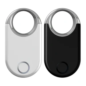
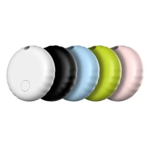
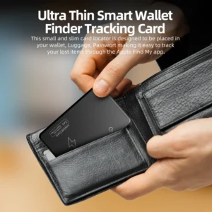
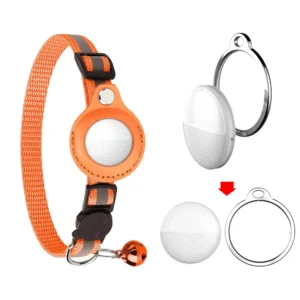
Such devices are the most common“Mini-models” in the consumer market, looking like coins or keychains and relying on near-field communications for tracking.
![]()
Effective distance: single device directly connected, the effective distance of 10-100 meters (Bluetooth 5.0 theoretical value) , but the actual wall, metal shielding, usually reduced to 10-30 meters. For example, backpacks can be tracked up to 30 metres away in an open area, but the distance can be reduced to less than 5 metres if two walls separate them.
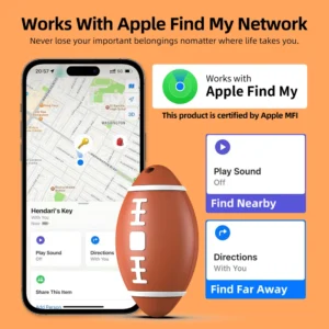
Reach: breaking through physical limits through“Social networking”-when devices are out of range of your phone and other users’ Bluetooth devices (e.g. iPhone, Android phone) are nearby, an anonymous relay uploads its location to the cloud. For example, an AirTag left on the New York subway can be checked by other iPhone users, while the owner in London can still check the latest location on the App.
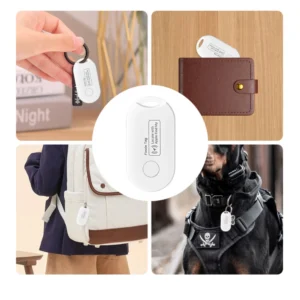
Typical scenarios: keys, wallets, backpacks, pet collars and other small items anti-lost, for the crowded urban environment.
2. Cellular network trackers (4G/5G SIM devices)
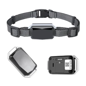
When it comes to real-time remote monitoring, mini-locators with built-in SIM cards, often about the size of a cigarette lighter, are the central option.
![]()
Effective distance: no upper limit in theory, as long as there are mobile phone base station coverage area (more than 95% of the world’s inhabited areas) , real-time positioning. For example, a 4G locator mounted on a truck, shipped from the U. S. to Europe, can view real-time trajectories across the platform.
Dependencies: must insert active SIM card and subscribe to data plan -5-205USD USD/month) , and is limited by carrier network coveraRemotemMountaintain, deep sea, desert, etcNo. no base station area failure) .
Typical scenarios: vehicle theft prevention, Fleet Management, security monitoring of the elderly and children (such as smart watches with positioning functions) , cross-border logistics monitoring.
3. Satellite trackers (Garmin Inreach Mini, Spot X)
These devices are the“Ultimate Solution” for extreme environments, being slightly larger than Bluetooth models (usually the size of a credit card) but able to work reliably in areas where there is no cellular signal at all.
Effective distance: global non-blind coverage, including Mount Everest, the South Pacific, the Sahara desert and other extreme environments. Its signal communicates directly with the low Earth orbit satellite (like Iridium satellite, global star) , is not limited by the ground base station.
Disadvantages: high hardware costs (about 500-1500 USD) and mandatory satellite subscriptions (150-800 USD per year) ; low frequency of location updates (usually 10 minutes-1 hour, high-frequency updates can drain battery quickly) .
Typical scenarios: Polar Expeditions, ocean voyages, forest surveys, high-risk operations, is the last line of protection of life safety.
4. Hybrid trackers
To balance coverage with cost, “Multi-technology fusion” Mini-locators (such as Invoxia Pet Tracker and Tracki Mini) have emerged in recent years that are similar in size to airtags but can be adapted to complex scenarios from indoors to wilderness.
Combination mode: usually integrated GPS (satellite positioning) + Bluetooth (close blind) + WiFi (indoor positioning) + Lorawan (long-distance low power consumption) four technologies.
Indoor or close: automatically switch to Bluetooth/WIFI, positioning accuracy of 5-50 meters, suitable for home, shopping malls and other scenarios;
City outdoor: Enable 4G network, real-time location updates, covering the city;
Suburban or remote areas: switch to Lorawan (Long-distance low-power protocol) , a single base station covering more than 10 km, up to 3-6 months (suitable for farm livestock, field equipment tracking) .
Typical scenario: objects that require cross-scenario monitoring, such as outdoor pets, logistics containers, long-distance trucks, etc. .
![]()
5 key factors affecting actual distance
The type of technology determines the“Theoretical range”, but in real use, the following factors may make the effective distance of the locator“Discount” or even completely ineffective.
1. Physical shielding: the“Stealth barrier” of signals
GPS, Bluetooth, and cellular signals are radio waves that are severely weakened when they hit metal, concrete, or water:
Metal housing/shielding environment: with the locator in the trunk of the car (metal enclosure) or wrapped in aluminum foil, the GPS signal may be completely interrupted and the Bluetooth distance reduced from 30 meters to 1-2 meters.
Dense buildings/natural obstacles: High-rise buildings in cities (the“Urban Canyon effect”) cause GPS signals to bounce back and drift; dense forest canopies and deep mountain canyons absorb signals, the effective range of 4G base stations is dramatically reduced from 10km to less than 1km.
Solution: give preference to devices that support“Multi-mode positioning”(e.g. , GPS + GLONASS) or Bluetooth/WiFi assisted positioning (for indoor scenarios) .
2. Quality of network coverage: the“Sphere of influence” of base stations and satellites
Cellular network (4G/5G) : in developed countries in Europe and the United States, urban areas of base station coverage rate of 99% , but Alaska wilderness, Africa, the edge of the Sahara and other areas there are still a lot of“Signal blind spot.”. For example, parts of the Yukon Territory in northern Canada have lost 4G altogether, turning cellular locators into“Off-line loggers”(local tracks only, no real-time backhaul) .
Satellite network: Iridium, global star system although called“No dead end”, but in extreme weather (such as heavy rain, thunderstorms) or solar magnetic storms, the signal may be delayed or lost.
Suggestion: before buying, check the network coverage map of the target area (available on the operator’s website) , and give priority to satellite locators in extreme environments.
![]()
3. Power management: a balancing act between range and battery life
The“Range” of a locator isn’t just a spatial concept. It’s also limited by its battery life-no matter how strong the signal is, it won’t work with a dead device:
Real-time update mode: If you set a minute to update a location, 4G locator battery life is usually only 1-3 days, once the power, “Effective distance” to zero.
Smart power-saving mode: the device sleeps when stationary, automatically activates positioning when moving (judged by the built-in accelerometer) , and the cellular locator can last for 1-3 months, gPS can even be extended to 6-12 months (eg Garmin in reach Mini 2’s“Adventure Mode”) .
Decision-making suggestions: according to the monitoring frequency needs to choose the mode, such as tracking pets can be set“Mobile activation”, vehicle anti-theft need“Real-time update”.
4. Policy and regulatory constraints: the invisible“Distance ceiling”
Different countries have strict regulations on the use of positioning technology, which directly affect the actual available distance:
Privacy Laws: the European Union’s General Data Protection Regulation (GDPR-RRB- requires that civilian location accuracy be no higher than 100 meters (to avoid over-monitoring) , leading to some devices soldEuroperope being deliberately inaccurate.
Regional Signal Control: North Korea, Iran and other countries to disable some civilian GPS signal, foreign purchases of locators in such areas may be completely ineffective.
General note: confirm the technical standard of the target country before use, to avoid the equipment can not work due to the frequency band incompatibility or policy restrictions.
5. Device sensitivity differences: the chip determines“Signal capture power”
For the same type of device, the effective distance can vary several times depending on the quality of the chip:
High-end chips, such as the Swiss u-blox F 9 series (commonly used in professional GPS devices) , can pick up more satellite signals in weak signal environments (such as urban canyons and under trees) and locate them 30% to 50% farther than ordinary chips.
Low-cost solutions: some 50 USD within the mini-locator using inferior chips, positioning error in the open area has reached 50-100 meters, a little shelter will be completely ineffective.
Identification method: look at the“Cold start time”(the shorter the better, usually < 30 seconds) and“Tracking sensitivity”(the lower the value, the stronger the ability to capture weak signals, such as -167 DBM is better than -155 dbm) in the product parameters.
Comparison of test data in real scene
To visually demonstrate the performance of different technologies, we tested three mainstream locators in four typical scenarios, and the results are as follows:
| Scenarios | AirTag | 4G Tracki | Garmin inReach |
| In the same room (100m2) | normal (error < 5 m) | normal (error < 3 m) | normal (error < 10m) |
| G3 parking lot | No contact at all | ocation delay (5-10 min update) | normal (error < 20 m) |
| Transcontinental Expressway (1000 km) | Out of range (relying on accidental relays) | real-time update (error < 10 m) | real-time update (error < 15 m) |
| An uninhabited island in the South Pacific (no signal) | Total failure | local records only | Normal (support SOS for help) |
Common user misconceptions
Myth # 1: “GPS = real-time transmission”
FACT: GPS is only responsible for“Receiving satellite signals to calculate location”, and the transmission of location data back to the phone/platform must rely on Bluetooth, 4G or satellite communications. For example, a mini-locator with only a GPS chip can record a trajectory but can not share it in real time. The“Range” is actually zero (you can’t view it remotely) .
Myth # 2: “Mini = weak performance”
Fact: with the miniaturization of chips, the performance of mini-devices has improved dramatically. Huawei’s 4G locator, for example, measures 2cm by 3cm and has a positioning accuracy of 1m and a battery life of 30 days, indistinguishable from a traditional bulky device. The device’s performance depends on the type of technology, not its size.
Myth # 3: “It’s cheaper to buy a device without a monthly fee”
FACT: most free monthly locators are bluetooth-based (e.g. , AirTag) , rely on social networks, and don’t work in sparsely populated areas, a monthly cellular/GPS fee (usually 5-30 USD) is a necessary investment to avoid“Penny-pinching” that could result in monitoring failure.
Shopping Guide: Matching distance capabilities to needs
1. Short distance anti-lost (within 100 meters)
Requirements: keys, wallet, backpack, indoor pet (e.g. cat) .
Pros: Bluetooth tracker (Apple AirTag, Tile Mate) .
Budget: 20-50 USD per device, no monthly fees, 1-2 years of battery life (just replace the battery) .
Note: give preference to brands with a larger user base (e.g. apple’s“Find” network has wider coverage) .
2. real-time urban/suburban monitoring
Needs: Vehicle Security, child and elderly care, outdoor pet tracking or short-haul logistics.
Pros: Cellular GPS trackers (Tile Pro, Tracki) .
Budget: Device 50-100 USD, monthly fee 5-30 USD (including data + platform service) , battery life 1-3 months (rechargeable) .
Note: Confirm 4G coverage in the target area and select the model that supports electronic fence (border crossing alarm) .
3. No-man’s-land/cross-border/high-risk scenarios
Needs: Wilderness Expeditions, ocean voyages, geological exploration, cross-border trucks.
PROS: Satellite GPS tracker (Garmin Inreach Mini 2, Spot Gen4) .
Budget: Equipment 500-1500 USD, annual service charge 150-800 USD (based on positioning times and traffic) , battery life 1-6 months.
Note: International Rescue Services (such as GEOS) must be registered in advance to ensure SOS functionality is available worldwide.
Conclusion: Technology Evolution and future prospects
The“Range” of a mini-GPS is being rewritten by new technology:
Leo Satellite Internet: Starlink, OneWeb and other constellation plans, satellite communication costs will be reduced by 90% , the future 200-300 USD mini-satellite locator may be popular, completely eliminate the“Signal blind spot.”.
5G RedCap technology: a“Lightweight 5G” solution commercially available by 2024 will allow the locator to achieve 10 km of low-power coverage, real-time performance and battery life while maintaining its small size.
Smart switching system: the next generation of devices will automatically select the best network based on the environment (satellite →5G → Bluetooth → Lorawan) , such as using a satellite when climbing, and seamlessly cutting 5G after entering the city without manual intervention by the user.
Ultimately, the ultimate goal of location technology isn’t“Infinite distance.” It’s precisely guarding everything you hold dear in the right context, with the right technology. Understanding these principles will enable the mini-locator to truly become a reliable“Invisible guardian”.
Appendix: Explanation of key terms
Lorawan: Long-distance low-power Wan Protocol, a single base station covering 1-10 km, power consumption is only Bluetooth 1/10, suitable for farms, oil fields and other large areas of low-frequency monitoring.
AGPS: GPS-assisted technology, which uses mobile phone networks to get satellite orbit information in advance, cuts positioning start-up time from 5-10 minutes to less than 10 seconds, but relies on an initial network connection.
Geofencing: the user plots virtual areas on a map (e.g. , home, school) , and the locator automatically alarms when it enters or leaves, saving power and traffic by eliminating the need for constant location.

